In 1909, the Bureau of Economic Geology (Bureau) was created with the mission to increase the understanding of geology and geological resources, and stimulate the economy in Texas.
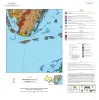
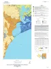
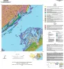
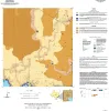
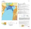
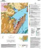
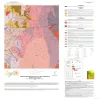
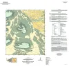
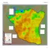
A series of two 1:500,000 scale maps showing the Geothermal resources of South Texas.