Publication Search

Bureau of Economic Geology Publications

Title Publication Year Sort ascending Abstract Author Publisher
Anatomy of a Paleozoic Basin: The Permian Basin, USA (vol. 1) Anatomy of a Paleozoic Basin: The Permian Basin, USA (vol. 1) 2019

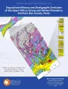
This is Volume 1 of a two-volume set. The set is the first comprehensive analysis of the Permian Basin in more than 60 years. Collectively, these chapters provide a spectrum of data and interpretations that characterize one of the largest hydrocarbon-producing super basins in the world.

Ruppel, S.C. Bureau of Economic Geology
Depositional History and Architectural Variability of the Wilcox Group in Texas: Core Workshop Depositional History and Architectural Variability of the Wilcox Group in Texas: Core Workshop 2018 Olariu, M.I., Ambrose, W.A., Olariu, Cornel, Steel, Ronald, Zhang, Jinyu Bureau of Economic Geology
Geologic map of the Kamey quadrangle, Texas Gulf of Mexico Coast Geologic map of the Kamey quadrangle, Texas Gulf of Mexico Coast 2018 Paine, J.G., Collins, E.W., Costard, L. Bureau of Economic Geology
Geologic map of the Point Comfort quadrangle, Texas Gulf of Mexico Coast Geologic map of the Point Comfort quadrangle, Texas Gulf of Mexico Coast 2018 Paine, J.G., Collins, E.W., Costard, L. Bureau of Economic Geology
Geologic map of the Somerset quadrangle, Texas Geologic map of the Somerset quadrangle, Texas 2018 Elliott, Brent A. Bureau of Economic Geology
Geologic map of Mansfield Dam, Jollyville, Austin West, and Bee Cave quadrangles, Central Texas (Lower Lake Travis and Lake Austin vicinity) Geologic map of Mansfield Dam, Jollyville, Austin West, and Bee Cave quadrangles, Central Texas (Lower Lake Travis and Lake Austin vicinity) 2018 Woodruff, C.M., Jr., Collins, E.W. Bureau of Economic Geology
Oil and Gas Map of Texas Oil and Gas Map of Texas 2018 Kim, E.M., Ruppel, S.C. Bureau of Economic Geology
Depositional History and Stratigraphic Evolution of the Upper Wilcox Group and Reklaw Formation, Northern Bee County, Texas Depositional History and Stratigraphic Evolution of the Upper Wilcox Group and Reklaw Formation, Northern Bee County, Texas 2018

The purpose of this atlas is to provide a summary of research undertaken as part of a multiyear study (2009–2014) of Texas State Waters and the adjacent Federal Offshore continental shelf (i.e., near offshore waters of the State of Texas).

Ambrose, W.A., Zeng, Hongliu, Zhang, Jinyu, Olariu, M.I., Smith, D., Clift, S.J. Bureau of Economic Geology
Geologic Map of the Shingle Hills-Dripping Springs-Driftwood-Rough Hollow-Henly-Hammetts Crossing Area, Central Texas Geologic Map of the Shingle Hills-Dripping Springs-Driftwood-Rough Hollow-Henly-Hammetts Crossing Area, Central Texas 2017 Collins, E.W. Bureau of Economic Geology
Geologic Map of the Seadrift NE Quadrangle, Texas Gulf of Mexico Coast Geologic Map of the Seadrift NE Quadrangle, Texas Gulf of Mexico Coast 2017 Paine, J.G., Collins, E.W. Bureau of Economic Geology