Bureau of Economic Geology Publications
| Title | Publication Year Sort ascending | Abstract | Author | Publisher | |
|---|---|---|---|---|---|
|
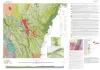
Bedrock geologic map of the Black Gap area and Sierra del Carmen Mountains, Trans-Pecos, Texas | 2024 | Hunt, B.B., Helper, M.A. | Bureau of Economic Geology | |
|
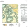
Geologic map of the Norton Mesa quadrangle, Texas | 2024 | Elliott, Brent A. | Bureau of Economic Geology | |
|
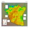
Geothermal Resources, South Texas | 2024 | A series of two 1:500,000 scale maps showing the Geothermal resources of South Texas. |
Andrews, J.R. | Bureau of Economic Geology |
|
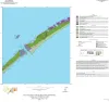
Geologic map of the Decros Point quadrangle, Texas Gulf Of Mexico Coast | 2024 | Aerial imagery used in this study included 0.6- and 1.0-m pixel, natural color, National Agriculture Imagery Program digital imagery photographed in 2020 and 2022. |
Morris, J.N., Paine, J.G. | Bureau of Economic Geology |
|
Regional and Local Variability in Lowstand Valley Fill and Deltaic Deposits in the Tannehill Sandstone (Cisco Group), Eastern Shelf of the Permian Basin | 2024 | Lowstand valley fill and shelf-edge deltaic deposits in the Tannehill sandstone (Wolfcampian Cisco Group) in the Eastern Shelf of the Permian Basin are major targets for oil and gas exploration. |
Ambrose, W.A., Hentz, T.F., Rogers, H., Carr, D.L. | Bureau of Economic Geology |
|
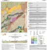
Geologic map of the Loyal Valley quadrangle, Mason County, Texas | 2024 | Hunt, B.B., Helper, M.A., Morris, J.N., Mutis-Duplat, Emilio, Gray, M.W. | Bureau of Economic Geology | |
|
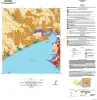
Geologic Map of the Lamar Quadrangle, Texas Gulf Coast | 2024 | This 1:24,000-scale geologic map of the Lamar 7.5-minute quadrangle shows the distribution of unconsolidated to semiconsolidated Holocene and Pleistocene geologic units deposited on the Texas coastal plain in fluvial, deltaic, bay, estuarine, lagoonal, and Gulf-margin environments. |
Paine, J.G., Morris, J.N., Grunau, B.A. | Bureau of Economic Geology |
|
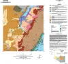
Geologic map of the Aransas Pass quadrangle, Texas Gulf coast | 2024 | This 1:24,000-scale geologic map of the Aransas Pass 7.5-minute quadrangle shows the distribution of unconsolidated to semiconsolidated Holocene and Pleistocene geologic units deposited on the Texas coastal plain in fluvial, deltaic, bay, estuarine, lagoonal, and Gulf-margin environments. |
Paine, J.G., Grunau, B.A., Morris, J.N. | Bureau of Economic Geology |
|
Geologic map of the Art quadrangle, Mason County, Texas | 2024 | Hunt, B.B., Helper, M.A., Grunau, B.A., Mutis-Duplat, Emilio, Gray, M.W. | Bureau of Economic Geology | |
|
Geologic map of the Panther Creek quadrangle, Mason County, Texas | 2023 | Hunt, B.B. | Bureau of Economic Geology |