Publication Year
1996
Publisher
Series
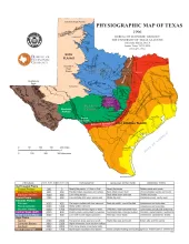
Open-File Map
Publication Year
1996
Publisher
Series
Open-File Map
Publication Year
1996
Publisher
Series
Geological Circular
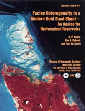
Abstract
The ooid-sand shoals of the Joulters Cays area of Great Bahama Bank were chosen for detailed sedimentologic study to investigate patterns of internal heterogeneity within a modern carbonate sand deposit and to develop criteria for predicting the lateral extent of porous and permeable carbonate grainstone facies in hydrocarbon reservoirs. Using aerial photographs, surface observations, and shallow coring, we documented three sedimentary facies in a 2.7-km2 (1-mi2) study area dominated by mobile ooid sands.
Publication Year
1996
Publisher
Series
Open-File Map
Publication Year
1996
Publisher
Series
Thematic Maps