Publication Details
Geolocation:
Get the Publication
$25.00
Abstract/Description:
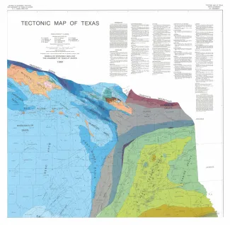
4 oversized sheets, Lambert Conformal Conic projection based on standard parallel 33 degrees and 45 degrees. Accompanied by a text booklet, The Tectonic Framework of Texas.
This large map, which is in four quadrants, incorporates extensive surface and subsurface data from all areas of Texas, as well as adjoining parts of Mexico, New Mexico, Oklahoma, Arkansas, Louisiana, and the Gulf of Mexico. Lithotectonic units are shown in areas of basement exposure, such as the Van Horn area of Trans-Pecos Texas and the Llano region of Central Texas. Subsurface stratigraphic horizons are shown in many sedimentary basins of Texas. Small-scale inset maps depict statewide gravity, magnetic, neotectonics, and isotopic age data. The accompanying text, The Tectonic Framework of Texas, describes the complex tectonic setting and evolution of Texas.