Trans-Pecos Publications
| Title | Publication Year Sort ascending | Abstract | Author | Series | Publisher | |
|---|---|---|---|---|---|---|
|
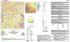
Geologic Map of the Toyahvale Quadrangle, Jeff Davis and Reeves Counties, Texas | 2025 | Hunt, B.B., Helper, M.A., Horne, E.A., Hennings, P.H., Rhoden, E. | Open-File Map | Bureau of Economic Geology | |
|
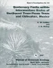
Quaternary faults within intermontane basins of northwest Trans-Pecos Texas and Chihuahua, Mexico | 1997 | This report details the occurrence, geometries, scarp morphology, and paleorupture histories of Quaternary faults of northwest Trans-Pecos Texas and northern Chihuahua, Mexico. |
Collins, E.W., Raney, J.A. | Report of Investigations | Bureau of Economic Geology |
|
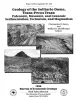
Geology of the Solitario dome, Trans-Pecos Texas: Paleozoic, Mesozoic, and Cenozoic sedimentation, tectonism, and magmatism | 1996 | The Solitario is a circular, 14- to 16-krn-diameter, mid-Tertiary laccolithic dome and caldera in southern Trans-Pecos Texas; it is among the world's largest laccoliths. |
Henry, C.D., Muehlberger, W.R., McCormick, C.L., Smith, C.I., Erdlac, R.J., Davis, L.L., Kunk, M.J. | Report of Investigations | Bureau of Economic Geology |
|
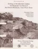
Geology of the Infiernito caldera and magmatic evolution of the Chinati Mountains, Trans-Pecos Texas | 1992 | The 37-Ma-old Infiernito caldera of the northern Chinati Mountains is a major eruptive center of the mid-Tertiary volcanic field of Trans-Pecos Texas. Volcanism in the Chinati Mountains began with eruption of a sequence of rhyolitic to trachytic lavas, the precollapse lavas. |
Henry, C.D., Price, J.G., Duex, T.W., James, E.W. | Report of Investigations | Bureau of Economic Geology |
|
Tertiary and Quaternary structure and paleotectonics of the Hueco Basin, Trans-Pecos Texas and Chihuahua, Mexico | 1991 | The Hueco Basin of Trans-Pecos Texas, which formed in response to Cenozoic extensional tectonism, lies within the southern Rio Grande rift near the poorly defined boundary between the rift and the southern Basin and Range province. |
Collins, E.W., Raney, J.A. | Geological Circular | Bureau of Economic Geology |
|
Integration of ground-water and vadose-zone geochemistry to investigate hydrochemical evolution: a case study in arid lands of the northern Chihuahuan Desert, Trans-Pecos Texas | 1990 | The hydrochemical history of ground water in the arid southeastern Hueco Bolson and southwestern Diablo Plateau was investigated by collecting soil-moisture samples from unsaturated siliciclastic bolson-fill sediments and groundwater samples from the Diablo Plateau aquifer, the Hueco Bolson silt |
Fisher, R.S., Mullican, W.F. | Geological Circular | Bureau of Economic Geology |
|
Neotectonic history and structural style of the Campo Grande fault, Hueco basin, Trans-Pecos Texas | 1990 | The Hueco Basin of Trans-Pecos Texas and Chihuahua, Mexico, formed in response to Basin and Range extensional tectonism that began about 24 Ma ago and continues to the present. |
Collins, E.W., Raney, J.A. | Report of Investigations | Bureau of Economic Geology |
|
Hydrogeology of Trans-Pecos Texas | 1990 | This guidebook, Hydrogeology of Trans-Pecos Texas, grew out of our interest in the hydrogeology of desert environments. |
Kreitler, C.W., Sharp, J.M. | Guidebook | Bureau of Economic Geology |
|
Geology and Tertiary igneous activity of the Hen Egg Mountain and Christmas Mountains quadrangles, Big Bend region, Trans-Pecos Texas | 1989 | Cretaceous sedimentary rocks and Tertiary intrusive, extrusive, and volcaniclastic rocks dominate the geology of the Hen Egg Mountain and Christmas Mountains quadrangles in the Big Bend region of Texas. |
Henry, C.D., Price, J.G., Miser, D.E. | Report of Investigations | Bureau of Economic Geology |
|
Geologic occurrence and regional assessment of evaporite-hosted native sulfur, Trans-Pecos Texas | 1989 | In the western Delaware Basin and southern Central Basin Platform of Trans-Pecos Texas, Upper Permian (Ochoan) evaporite strata host locally voluminous but notoriously unpredictable, sporadic deposits of biogenic native sulfur. |
Hentz, T.F., Price, J.G., Gutierrez, G.N. | Report of Investigations | Bureau of Economic Geology |