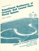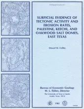
Surficial geologic investigations at Palestine, Keechi, and Oakwood salt domes have provided information necessary for evaluating these domes as nuclear waste repositories. Diapir growth uplifted sediments to form domes and created complex radial faulting. Cretaceous rocks crop out at Palestine and Keechi Domes, whereas only Eocene Claiborne sediments are exposed over Oakwood Dome. Annular drainage patterns at Oakwood and Palestine Domes reflect the domal structure.
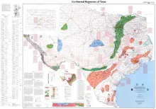
This public-oriented user map shows the generalized extent of geothermal aquifers in Texas. It includes locations and tabular data for selected wells that have representative temperatures and water-quality attributes of the various aquifers.
Mobilization of the Louann Salt created the present structural configuration in the central part of the East Texas Basin and was the major control on hydrocarbon accumulation in the area. Salt-cored anticlines, turtle-structure anticlines, and salt diapirs were produced by flow of salt. Of these, the most prolific oil- and gas-producing structures have been anticlines with deep salt cores. These deep-seated salt domes uplifted thick stratigraphic sections; thus, their crestal anticlines are multiple-zoned productive structures.