|
Northern Gulf of Mexico Sandstone Reservoir-Quality Database (GOMRQ): Multiple Data Types for Evaluating Reservoir-Quality Risk |
2023 |
|
Loucks, R.G., Dutton, S.P. |
Report of Investigations |
Bureau of Economic Geology |
|
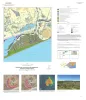
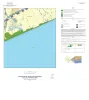
Geologic map of the High Island quadrangle, Texas Gulf of Mexico Coast |
2022 |
|
Caudle, T.L., Paine, J.G., Andrews, J.R. |
Open-File Map |
Bureau of Economic Geology |
|
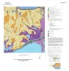
Geologic map of the Palacios NE quadrangle, Texas Gulf of Mexico Coast |
2022 |
|
Paine, J.G., Costard, L. |
Open-File Map |
Bureau of Economic Geology |
|
Geologic map of the Palacios SE quadrangle, Texas Gulf of Mexico Coast |
2022 |
|
Paine, J.G., Costard, L., Caudle, T.L. |
Open-File Map |
Bureau of Economic Geology |
|
Geologic map of the Mud Lake quadrangle, Texas Gulf of Mexico Coast |
2022 |
|
Caudle, T.L., Paine, J.G. |
Open-File Map |
Bureau of Economic Geology |
|
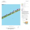
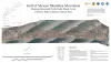
Gulf of Mexico Shoreline Change, Mustang Island and North Padre Island, Texas: Northern Padre Island to Aransas Pass |
2021 |
|
Caudle, T.L., Paine, J.G., Andrews, J.R., Suarez, J.R. |
Posters |
|
|
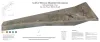
Gulf of Mexico Shoreline Change, Galveston Island, Texas: San Luis Pass to Bolivar Roads |
2021 |
|
Caudle, T.L., Paine, J.G., Andrews, J.R., Suarez, J.R. |
Posters |
|
|
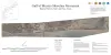
Gulf of Mexico Shoreline Change, Brazos River to San Luis Pass, Texas |
2021 |
|
Caudle, T.L., Paine, J.G., Andrews, J.R., Suarez, J.R. |
Posters |
|
|
Gulf of Mexico Shoreline Change, High Island to Sabine Pass, Texas |
2021 |
|
Caudle, T.L., Paine, J.G., Andrews, J.R., Suarez, J.R. |
Posters |
|
|
Gulf of Mexico Shoreline Change, Western Matagorda Peninsula, Texas: Pass Cavallo to Colorado River |
2021 |
|
Caudle, T.L., Paine, J.G., Andrews, J.R., Suarez, J.R. |
Posters |
|