Publication Details
Publication Year
1968
Map Scale
1:250000
Publication Code
GA0004
Series
Geologic Atlas of Texas
Publisher
Geolocation:
Get the Publication
Available to Purchase:
$14.00
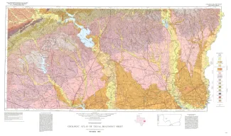
Abstract/Description:
Geologic map that depicts the surface geology of Montgomery, San Jacinto, and Hardin Counties and parts of Madison, Trinity, Polk, Tyler, Jasper, Newton, Orange, Jefferson, Liberty, Harris, Waller, Grimes, Walker, and Robertson Counties. The 4-page booklet indicates geologic formations, abbreviations, and ages. This Sheet is a memorial to the late Harold Norman Fisk, distinguished geologist who was associated with Humble Oil & Refining Company at the time of his death in 1964. Dr. Fisk, a specialist in Pleistocene and Recent geology of the southern United States, identified and named the Montgomery and Bentley Formations which are mapped on the Beaumont and Houston Sheets.