Publication Year
1989
Publisher
Series
Houston Geological Society
Publication Year
1989
Series
Gulf Coast Association of Geological Societies
Publication Year
1989
Series
Annual Reports
Abstract
Annual report for the Bureau of Economic Geology 1989
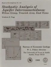
Publication Year
1989
Publisher
Series
Report of Investigations
Abstract
Detailed characterization of the spatial distribution of hydraulic conductivity (K) by direct measurement is usually impractical. A viable alternative is to use geologic information and geostatistics to characterize interconnectedness of critical K facies that have a dominant influence on fluid flow. Conditional simulation is introduced herein as a method for estimating aquifer interconnectedness.
Publication Year
1989
Publisher
Series
Mineral Resource Circular