East Texas Publications
| Title | Publication Year Sort ascending | Abstract | Author | Series | Publisher | |
|---|---|---|---|---|---|---|
|
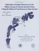
Estimation of lignite resources in the Wilcox Group of central and east Texas using the National Coal Resources Data System | 1991 | Since 1979, the U.S. Geological Survey (USGS) has funded cooperative programs with coal-bearing states in an effort to provide current U.S. coal resource estimates that are calculated by uniform, computerized methods. |
Tewalt, S.J., Jackson, M.L.W. | Geological Circular | Bureau of Economic Geology |
|
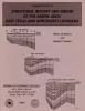
Structural history and origin of the Sabine Arch, east Texas and northwest Louisiana | 1991 | The Sabine Arch is a large (1 2,000 mi2 [31,000 km2]), low-amplitude anticline centered on the Texas-Louisiana border. |
Jackson, M.L.W., Laubach, S.E. | Geological Circular | Bureau of Economic Geology |
|
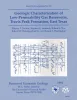
Geologic characterization of low-permeability gas reservoirs, Travis Peak Formation, East Texas | 1991 | The Lower Cretaceous Travis Peak Formation contains an estimated 6.4 trillion cubic feet (Tcf) of gas in place in East Texas and North Louisiana. Advanced technology will be needed to maximize recovery from this low-permeability ("tight") gas sandstone. |
Dutton, S.P., Laubach, S.E., Tye, R.S., Baumgardner, R.W., Jr., Herrington, K.L. | Report of Investigations | Bureau of Economic Geology |
|
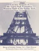
Fracture analysis of the Travis Peak Formation, western flank of the Sabine Arch, east Texas | 1989 | Successful development of low-permeability-sandstone gas reservoirs depends on an understandingof their natural fracture patterns and on predictions of the orientation of horizontal stresses.This report describes the preliminary results of fracture analysis of the Lower Cretaceous TravisPeak Form |
Laubach, S.E. | Report of Investigations | Bureau of Economic Geology |
|
Stochastic analysis of aquifer interconnectedness: Wilcox Group, Trawick area, east Texas | 1989 | Detailed characterization of the spatial distribution of hydraulic conductivity (K) by direct measurement is usually impractical. |
Fogg, G.E. | Report of Investigations | Bureau of Economic Geology |
|
Diagenesis and burial history of the Lower Cretaceous Travis Peak Formation, east Texas | 1987 | Sandstone in the Travis Peak (Hosston) Formation has been extensively modified by burial diagenesis. Permeability in much of the formation has been reduced to less than 0.1 md as a result of compaction, extensive precipitation of authigenic minerals, and minor pressure solution. |
Dutton, S.P. | Report of Investigations | Bureau of Economic Geology |

|
Geology and Ground-Water Hydrology of Deep-Basin Lignite in the Wilcox Group of East Texas | 1986 | Near-surface lignite resources in Texas, or those under less than 200 feet (61 m) of cover, are ample to meet the state's demand for lignite in this century. |
Kaiser, W.R., Ambrose, M.L. | Selected Reports | Bureau of Economic Geology |
|
Hydrogeochemistry of the vadose zone in unmined and reclaimed deposits at Big Brown lignite mine, east Texas | 1986 | In the subsurface and at the outcrop, waters in argillaceous deposits of the Calvert Bluff Formation (lower Eocene, Wilcox Group) are brackish to saline. |
Dutton, A.R. | Report of Investigations | Bureau of Economic Geology |
|
Natural Strain in Diapiric and Glacial Rock Salt, with Emphasis on Oakwood Dome, East Texas | 1985 | Structural styles in the gravity-driven, ductile flow processes of glaciers and diapirs are analyzed. When dampened by rainfall, salt glaciers flow rapidly under minute differential stress. |
Jackson, M.P.A. | Report of Investigations | Bureau of Economic Geology |
|
Observations from the east Texas seismic network (June 1981 - August 1982) | 1984 | Several microearthquake recording stations were operated as a network in the East Texas Basin beginning in June 1981. At least six certain and two probable earthquakes as well as hundreds of events of undetermined origin were recorded through August 1982. |
Pennington, W.D., Carlson, S.M. | Geological Circular | Bureau of Economic Geology |