The Wink Sink in Winkler County, Texas, formed on June 3, 1980. Within 24 hours it had expanded to a maximum width of 360 ft (110 m). On June 5, 1980, maximum depth of the sinkhole was 110 ft (34 m), and volume about 5.6 million ft3 (158,600 m3). Between June 3 and June 6, 1980, a large area bordering the south rim of the sink subsided about 10 ft (3 m) relative to the north side. Further subsidence of 1,456 ft (44.4 cm) occurred along the southern rim between July 19 and December 12, 1980.
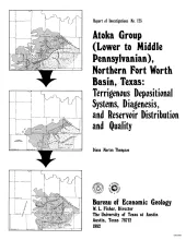
The Fort Worth Basin, in North-Central Texas, is a late Paleozoic foreland basin that was downwarped during the Early to Middle Pennsylvanian Period in response to tectonic stresses that also produced the Ouachita Thrust Belt. The Atoka Group was deposited during the initial westward progradation of chert-rich terrigenous clastics derived both from the Ouachita Thrust Belt and locally from the Muenster Arch across the northern part of the basin. At the northern end of the basin, the Atoka Group interfingers with arkosic conglomerates (granite wash) derived from the Red River-Electra Arch.

