Organic petrological, organic geochemical, and chemical analyses of Tertiary (Paleocene to Eocene) coals (to a 2,000-ft [610-m] depth) from the Wilcox, Claiborne, and Jackson Groups of Texas reveal characteristic properties of these coals. Most of the Wilcox, Claiborne (one sample), and Jackson coals contain greater amounts of liptinite (especially fine-grained liptodetrinite) than do average humic coals. These liptinites can be identified only by blue-light excitation in reflected-light microscopy.
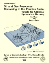
Reservoirs in the Permian Basin of Texas are estimated to have contained a total of 105.7 billion barrels (Bbbl) of oil at discovery. As of January 1985, these reservoirs had produced a cumulative volume of 25.3 Bbbl of oil, and proved reserves were calculated at 5.9 Bbbl. Thus, of original oil in place, and given a projected recovery efficiency of less than 30 percent at current development and technology, 74.5 Bbbl of oil will remain in Permian Basin reservoirs at depletion. Eighty-eight percent of this unrecovered oil lies at depths of less than 8,000 ft.
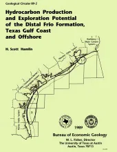
Along the Texas Gulf shoreline and offshore, the distal margin of the Frio Formation is a deep hydrocarbon province that is underexplored relative to the onshore Frio. Thick shelf and slope mudstones constitute most of the distal Frio, but deltaic, barrier/strandplain, shelf, and slope sandstones also occur, some of which are good reservoirs and established producers.
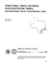
These cross sections illustrate the regional structure and stratigraphy beneath the Texas continental shelf . The Plio-Pleistocene Series in the western Gulf Coast basin comprises a thick wedge of terrigenous clastic sediment that produces modest volumes of hydrocarbons from offshore leases along the outer shelf and upper slope. Sandstone reservoirs within this wedge have yielded more than 40 million bbl of oil and 2.5 Tcf of gas.
In 1983, the Bureau of Economic Geology published the Atlas of Major Texas Oil Reservoirs, a precedent-setting synthesis of key geological and engineering data on 450 major oil reservoirs grouped into 48 regional plays. This volume, the Atlas of Major Texas Gas Reservoirs, is a companion to the earlier work. It contains information on more than 1,828 reservoirs, with emphasis on 868 reservoirs having cumulative production greater than 30 billion cubic feet of natural gas.