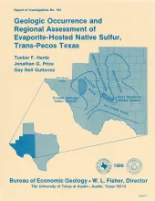
In the western Delaware Basin and southern Central Basin Platform of Trans-Pecos Texas, Upper Permian (Ochoan) evaporite strata host locally voluminous but notoriously unpredictable, sporadic deposits of biogenic native sulfur. The two sulfur-bearing regions, the Rustler Springs (Culberson and Reeves Counties) and Fort Stockton (Pecos County) sulfur districts, encompass about 2,000 State-owned tracts that are widely distributed throughout the two districts.
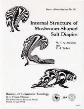
Mushroom-shaped diapirs have an overhanging bulb fringed by one or more skirts (peripheral pendant lobes), which can curl inward to form vortices capable of entraining cover rocks to various degrees. The highly complex anatomy of mushroom diapirs, some of which have double and eventriple cores, is analyzed in centrifuged and natural diapirs. We conducted 8 centrifuge experiments, which produced more than 100 model diapirs under acceleration equivalent to 1,200 times that of gravity. The experiments were dynamically scaled to U.S.
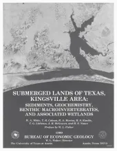
The State-owned submerged lands of Texas encompass almost 6,000 mi2 (15,540 km2). They lie below waters of the bay-estuary-lagoon system and the Gulf of Mexico and extend 10.3 mi (16.6 km) seaward from the Gulf shoreline (fig. 1). The importance of these lands and their resources to resident flora and fauna as well as to people is well known and documented; more than one-third of the state's population is concentrated within an area of the Coastal Zone that is only about one-sixteenth of the state's land area.
Cretaceous sedimentary rocks and Tertiary intrusive, extrusive, and volcaniclastic rocks dominate the geology of the Hen Egg Mountain and Christmas Mountains quadrangles in the Big Bend region of Texas. The Cretaceous rocks consist of limestones, shales, mudstones, and sandstones that are host rocks for the Tertiary intrusions.This report focuses on the Tertiary intrusive and extrusive rocks. The intrusions were emplaced in several distinct intervals between 47 and 20 Ma ago (Eocene to Miocene) but are dominantly 44 to 40 Ma old.