Bureau of Economic Geology Publications
| Title | Publication Year Sort ascending | Abstract | Author | Publisher | |
|---|---|---|---|---|---|
|
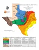
Physiographic Map of Texas | 1996 | Wermund, E.G. | Bureau of Economic Geology | |
|
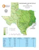
River Basin Map of Texas | 1996 | Wermund, E.G. | Bureau of Economic Geology | |
|
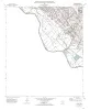
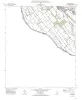
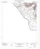
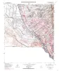
Geologic map of the Acala quadrangle, Texas | 1996 | Collins, E.W. | Bureau of Economic Geology | |
|
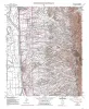
Geologic map of the Isla Quadrangle, Texas | 1996 | Collins, E.W. | Bureau of Economic Geology | |
|
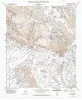
Geologic map of the McNary quadrangle, Texas | 1996 | Collins, E.W. | Bureau of Economic Geology | |
|
Geologic map of the Canutillo quadrangle, Texas | 1996 | Collins, E.W. | Bureau of Economic Geology | |
|
Geologic map of the Padre Canyon quadrangle, Texas | 1996 | Collins, E.W. | Bureau of Economic Geology | |

|
Combining P-Wave and S-Wave Seismic Data to Improve Prospect Evaluation | 1996 | This report presents three types of evidence documenting that the combination of P-wave and S-wave seismic data provides geologic insights that cannot be provided by conventional P-wave data alone. |
Hardage, B.A. | Bureau of Economic Geology |
|
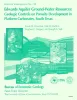
Edwards aquifer ground-water resources: geologic controls on porosity development in platform carbonates, south Texas | 1996 | Focusing on the highly developed Edwards aquifer, which supplies water for a large area of south-central Texas, this report presents a three-dimensional model of the porosity distribution in the aquifer, which quantifies the spatial distribution of water resources and provides information that ca |
Hovorka, S.D., Dutton, A.R., Ruppel, S.C., Yeh, J.S. | Bureau of Economic Geology |
|
Geologic map of the Smeltertown quadrangle, Texas | 1996 | Collins, E.W. | Bureau of Economic Geology |