Bureau of Economic Geology Publications
| Title | Publication Year Sort ascending | Abstract | Author | Publisher | |
|---|---|---|---|---|---|
|
Geologic map of the D'hanis Quadrangle, Texas | 1998 | Collins, E.W. | Bureau of Economic Geology | |

|
Geologic map of the Youngsport Quadrangle, Texas | 1998 | Collins, E.W. | Bureau of Economic Geology | |
|
Geologic map of the Salado Quadrangle, Texas | 1998 | Collins, E.W. | Bureau of Economic Geology | |
|
Geologic map of the Del Rio NE Quadrangle, Texas | 1998 | Collins, E.W. | Bureau of Economic Geology | |
|
Geologic map of the Timber Creek Quadrangle, Texas | 1997 | Collins, E.W. | Bureau of Economic Geology | |
|
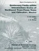
Quaternary faults within intermontane basins of northwest Trans-Pecos Texas and Chihuahua, Mexico | 1997 | This report details the occurrence, geometries, scarp morphology, and paleorupture histories of Quaternary faults of northwest Trans-Pecos Texas and northern Chihuahua, Mexico. |
Collins, E.W., Raney, J.A. | Bureau of Economic Geology |
|
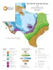
Tectonic Map of Texas | 1997 | University of Texas at Austin, Bureau of Economic Geology | Bureau of Economic Geology | |
|
Geologic map of the Twin Hollow Quadrangle, Texas | 1997 | Collins, E.W. | Bureau of Economic Geology | |
|
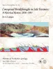
Conceptual Breakthroughs in Salt Tectonics: A Historical Review, 1856-1993 | 1997 | This report subjectively reviews the chief conceptual breakthroughs in understanding salt tectonics. Each discovery and its implications are presented as simply as possible. |
Jackson, M.P.A. | Bureau of Economic Geology |
|
Down to earth at McKinney Falls State Park, Texas | 1997 | Written in an informal style for a nontechnical audience, this guide summarizes geologic features and history of McKinney Falls State Park, just south of Austin, Texas. |
Raney, J.A. | Bureau of Economic Geology |