Bureau of Economic Geology Publications
| Title | Publication Year Sort ascending | Abstract | Author | Publisher | |
|---|---|---|---|---|---|

|
Naturally Occurring Radioactive Materials (NORM) in Produced Water and Scale from Texas Oil, Gas, and Geothermal Wells | 1995 | Water produced from oil, gas, and geothermal reservoirs contains natural radioactivity that ranges from background levels to levels found in uranium mill tailings. |
Fisher, R.S. | Bureau of Economic Geology |
|
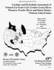
Geologic and Hydrologic Assessment of Natural Gas from Coal: Greater Green River, Piceance, Powder River, and Raton Basins, Western United States | 1995 | Five coal basins in the Rocky Mountain Foreland of the western United States--San Juan, Greater Green River, Piceance, Powder River, and Raton--contain, by virtue of their tremendous coal tonnage, 522 Tcf (14.7 Tm3) coalbed gas resources, or 77 percent of the nation's total of 675 Tcf (19.1 |
Tyler, Roger, Kaiser, W.R., Scott, A.R., Hamilton, D.S., Ambrose, W.A. | Bureau of Economic Geology |
|
Seismic analysis of the Duval County Ranch area, south Texas: assessment of exploration potential of the Wilcox, Queen City, and Jackson-Yegua plays | 1995 | Potential for commercial hydrocarbon accumulations in Eocene and older strata of the Duval County Ranch in South Texas was assessed using seismic data. Three seismic facies are recognized and tied to well control. |
Fiduk, J.C., Hamilton, D.S. | Bureau of Economic Geology |
|
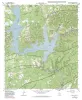
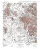
Geologic map of the Medina Lake Quadrangle, Texas | 1995 | Collins, E.W. | Bureau of Economic Geology | |
|
Origin and development of playa basins, sources of recharge to the Ogallala aquifer, southern High Plains, Texas and New Mexico | 1995 | More than 20,000 playa basins have formed on the Southern High Plains of Texas and New Mexico. |
Gustavson, T.C., Holliday, V.T., Hovorka, S.D. | Bureau of Economic Geology |
|
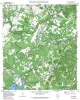
Geologic map of the Helms West Well Quadrangle, Texas | 1995 | Collins, E.W., Raney, J.A. | Bureau of Economic Geology | |
|
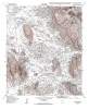
Geologic map of the Pipe Creek Quadrangle, Texas | 1995 | Collins, E.W. | Bureau of Economic Geology | |
|
Chert reservoir development in the Devonian Thirtyone Formation: Three Bar field, West Texas | 1995 | Chert reservoirs of the Lower Devonian Thirtyone Formation represent a substantial part of the hydrocarbon resource in the Permian Basin. More than 700 million barrels of oil has been produced from these rocks, and an equivalent amount of mobile oil remains. |
Ruppel, S.C., Hovorka, S.D. | Bureau of Economic Geology |
|
Geologic map of the Hueco Tanks Quadrangle, Texas | 1995 | Collins, E.W., Raney, J.A. | Bureau of Economic Geology | |
|
Flow-Unit Characterization and Recovery Optimization of a Braid-Delta Sandstone Reservoir, Tirrawarra Oil Field, South Australia | 1995 | The Tirrawarra Sandstone is the primary producing zone at Tirrawarra field in the Cooper Basin of South Australia, where it contains 146 million barrels (MMbbl) of unrecovered oil. |
Hamlin, H.S., Dutton, S.P., Seggie, R.J., Tyler, Noel, Yeh, J.S. | Bureau of Economic Geology |