Bureau of Economic Geology Publications
| Title | Publication Year Sort ascending | Abstract | Author | Publisher | |
|---|---|---|---|---|---|
|
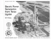
Electric Power Generation from Texas Lignite | 1978 | Lignite is a rediscovered energy in Texas because lignite-produced energy is 3 to 7 times cheaper than intrastate natural gas. Production has risen from 18,000 short tons in 1950 to 14 million tons in 1976 and will exceed 50 million tons by 1985. |
Kaiser, W.R. | Bureau of Economic Geology |
|
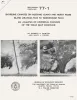
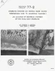
Catahoula Formation of the Texas coastal plain: depositional systems, composition, structural development, ground-water flow history, and uranium distribution | 1977 | The Catahoula Formation of the Texas Gulf Coastal Plain consists of two depositional systems--the Gueydan bedload fluvial system of the Rio Grande embayment and the Chita-Corrigan mixed load fluvial system of the Houston embayment. |
Galloway, W.E., Murphy, T.D., Belcher, R.C., Johnson, B.D., Sutton, Stanley | Bureau of Economic Geology |
|
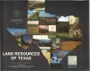
Land resources of Texas | 1977 | Texas is endowed with an enormous variety of natural land resources that vary from the humid forest lands of East Texas to the vast desert lands of Trans-Pecos, from the swamps and marshes of the Texas Coastal Zone to the arid plains of the Panhandle, and from the rich farmland of Central Texas t |
Kier, R.S., Garner, L.E., Brown, L.F., Jr., University of Texas at Austin, Bureau of Economic Geology | Bureau of Economic Geology |
|
Tectonic map of the Rio Grande area, Trans-Pecos Texas and adjacent Mexico | 1977 | Henry, C.D., Bockoven, N.T. | Bureau of Economic Geology | |
|
Geology of the Click Quadrangle, Llano and Blanco Counties, Texas | 1977 | Barnes, V.E. | Bureau of Economic Geology | |
|
Shoreline changes on Mustang Island and North Padre Island (Aransas Pass to Yarborough Pass) -- an analysis of historical changes of the Texas Gulf shoreline | 1977 | Historical monitoring along Mustang and north Padre Islands records the nature and magnitude of changes in position of the shoreline and vegetation line and provides insight into the factors affecting those changes. |
Morton, R.A., Pieper, M.J. | Bureau of Economic Geology |
|
Shoreline changes on central Padre Island (Yarborough Pass to Mansfield Channel) -- an analysis of historical changes of the Texas Gulf shoreline | 1977 | Historical monitoring along central Padre Island records the nature and magnitude of changes in position of the shoreline and vegetation line and provides insight into the factors affecting those changes. |
Morton, R.A., Pieper, M.J. | Bureau of Economic Geology |
|
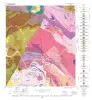
Environmental geologic Atlas of the Texas coastal zone -- Kingsville area | 1977 | The Texas Coastal Zone is marked by diversity in geography, resources, climate, and industry. |
Brown, L.F., Jr., McGowen, J.H., Evans, T.J., Groat, C.G., Fisher, W.L. | Bureau of Economic Geology |
|
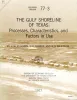
The Gulf shoreline of Texas: processes, characteristics, and factors in use | 1977 | The State of Texas has about 367 miles of open Gulf shoreline, most of it typified by rather broad, sandy beaches and a comparatively mild climate that permits almost year-round use of this recreational resource. All but about 87 miles of the Gulf beach is accessible to the general public. |
McGowen, J.H., Garner, L.E., Wilkinson, B.H. | Bureau of Economic Geology |
|
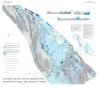
Hydrogeology of Gulf coast aquifers, Houston-Galveston area, Texas | 1977 | Aquifers in the Houston-Galveston area are composed principally of fluvial-deltaic sediments. The Alta Loma Sand is a complexly faulted, high-sand-percent unit that represents a seaward progression of fluvial, delta-plain, and delta-front facies. |
Kreitler, C.W., Guevara, E.H., Granata, G.E., McKalips, D.G. | Bureau of Economic Geology |