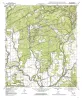
This Report of Investigations describes a geological, petrophysical, and reservoir engineering study of the South Cowden field, Ector County, in West Texas. This product is the downloadable version.
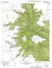
Located in Nueces County, 5 mi southeast of Aransas Pass in Corpus Christi Bay, Red Fish Bay field has yielded more than 19 MMbbl of liquid hydrocarbons and 103 Bcf of gas from more than 50 stacked Frio Sandstone reservoirs since field discovery in 1950.
Fluvial-deltaic reservoirs contain large volumes of oil and gas. These reservoirsandstones may have complex stacking patterns, and shales or very fine grained sandstone may form baffles or barriers to flow.