Bureau of Economic Geology Publications
| Title | Publication Year Sort ascending | Abstract | Author | Publisher | |
|---|---|---|---|---|---|
|
3-D seismic interpretation of deep, complex structures in the Delaware Basin, West Texas | 1999 | A multidisciplinary reservoir-characterization study of the Ellenburger Group was conducted over a 176-mi2 3-D seismic grid in Pecos, Reeves, and Ward Counties in the southern Delaware Basin of West Texas. |
Hardage, B.A., Pendleton, V.M., Asquith, G.B. | Bureau of Economic Geology |
|
Geologic and engineering characterization of turbidite reservoirs, Ford Geraldine Unit, Bell Canyon Formation, West Texas | 1999 | This report summarizes results of an integrated geological, geophysical, petrophysical, and engineering study of a representative Delaware Mountain Group field to identify constraints on producibility in the deep-water sandstone reservoir exhibiting low primary recovery efficiency. |
Dutton, S.P., Barton, M.D., Asquith, G.B., Malik, M.A., Cole, A.G., Gogas, John, Guzman, J.I., Clift, S.J. | Bureau of Economic Geology |
|
Groundwater availability in the Carrizo-Wilcox aquifer in central Texas -- numerical simulations of 2000 through 2050 withdrawal projections | 1999 | Between 1951 and 1996, groundwater pumpage from the Carrizo-Wilcox aquifer, one of Texas' major aquifer systems, increased in the area between the Colorado and Brazos Rivers from approximately 10,600 to 37,900 acre-ft/yr, primarily as a result of mining needs. |
Dutton, A.R. | Bureau of Economic Geology |
|
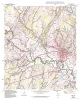
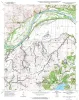
Geologic map of the Comanche Waterhole quadrangle, Texas | 1999 | Collins, E.W. | Bureau of Economic Geology | |
|
Using airborne geophysics to identify salinization in West Texas | 1999 | Salinization of soil and water is a chronic environmental and agricultural problem in arid regions. |
Paine, J.G., Dutton, A.R., Blum, M.U. | Bureau of Economic Geology |
|
Geologic map of the Briggs quadrangle, Texas | 1999 | Collins, E.W. | Bureau of Economic Geology | |
|
Geologic map of the Nameless Quadrangle, Texas | 1999 | Collins, E.W. | Bureau of Economic Geology | |
|
Geologic map of the Flat Rock Crossing Quadrangle, Texas | 1999 | Collins, E.W. | Bureau of Economic Geology | |
|
Geologic map of the Luling quadrangle, Texas | 1999 | Collins, E.W. | Bureau of Economic Geology | |
|
Geologic map of the Prairie Valley School quadrangle, Texas | 1999 | Collins, E.W. | Bureau of Economic Geology |