Bureau of Economic Geology Publications
| Title | Publication Year Sort ascending | Abstract | Author | Publisher | |
|---|---|---|---|---|---|
|
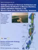
Geologic Controls on Reservoir Architecture and Hydrocarbon Distribution in Miocene Shoreface Fluvial and Deltaic Deposits in the Mioceno Norte Area, Lake Maracaibo, Venezuela | 1998 | Facies architecture, structure, and diagenesis control reservoir geometry and distribution of remaining oil in shoreface, fluvial, and deltaic reservoirs of Miocene age in the 18-mi2 (46.7-km2) Mioceno Norte Area in northern Lake Maracaibo. |
Ambrose, W.A., Mendez, M., Akhter, M.S. | Bureau of Economic Geology |
|
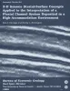
3-D Seismic Stratal-Surface Concepts Applied to the Interpretation of a Fluvial Channel System... | 1998 | A fundamental thesis of seismic stratigraphy is that seismic reflections follow impedance contrasts that coincide with stratal surfaces, which are surfaces where depositional processes occur at a fixed moment in geologic time. |
Hardage, B.A., Remington, R.L. | Bureau of Economic Geology |
|
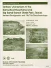
Tertiary volcanism of the Boficillos Mountains and Big Bend Ranch State Park, Texas: revised stratigraphy and 40Ar/39Ar geochronology | 1998 | The Bofecillos Mountains and Big Bend Ranch State Park contain a complex sequence of volcanic, volcaniclastic, and intrusive rocks that erupted from sources both within and outside the area. |
Henry, C.D., Davis, L.L., Kunk, M.J., McIntosh, W.C. | Bureau of Economic Geology |
|
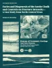
Facies and diagenesis of the Austin Chalk and controls on fracture intensity -- a case study from north-central Texas | 1998 | The urban corridors associated with the Dallas, Austin, and San Antonio metropolitan areas lie on Austin Chalk outcrop. In these areas of rapid urbanization, ground-water information is needed to resolve environmental issues. The Austin Chalk also produces hydrocarbons in the deep subsurface. |
Hovorka, S.D. | Bureau of Economic Geology |
|
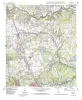
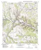
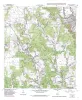
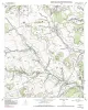
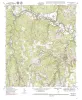
Geologic map of the Leander Quadrangle, Texas | 1998 | Collins, E.W. | Bureau of Economic Geology | |
|
Geologic map of the Leander NE Quadrangle, Texas | 1998 | Collins, E.W. | Bureau of Economic Geology | |
|
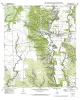
Geologic map of the Castroville quadrangle, Texas | 1998 | Collins, E.W. | Bureau of Economic Geology | |
|
Geologic map of the Florence quadrangle, Texas | 1998 | Collins, E.W. | Bureau of Economic Geology | |
|
Geologic map of the Ding Dong Quadrangle, Texas | 1998 | Collins, E.W. | Bureau of Economic Geology | |
|
Geologic map of the D'hanis Quadrangle, Texas | 1998 | Collins, E.W. | Bureau of Economic Geology |