Bureau of Economic Geology Publications
| Title | Publication Year Sort ascending | Abstract | Author | Publisher | |
|---|---|---|---|---|---|
|
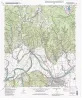
Geologic map of the Smithville Quadrangle, Texas | 2001 | Collins, E.W. | Bureau of Economic Geology | |
|
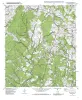
Geologic map of the Smithville NW Quadrangle, Texas | 2001 | Collins, E.W. | Bureau of Economic Geology | |
|
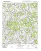
Geologic map of the Beaukiss quadrangle, Texas | 2001 | Collins, E.W. | Bureau of Economic Geology | |
|
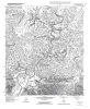
Geologic map of the Circle Bluff quadrangle, Texas | 2001 | Collins, E.W. | Bureau of Economic Geology | |
|
Using 3-D Seismic Coherency and Stratal Surfaces to Optimize Redevelopment of Waterflooded Reservoirs, Cut Bank Field, Montana | 2001 | In a 3-D seismic survey, we acquired data over an 8-mi2 section of Cut Bank field, located on the west flank of Sweetgrass Arch in Glacier County, Montana. The main objective of the study was to improve the results of an ongoing waterflood program. |
DeAngelo, M.V., Hardage, B.A. | Bureau of Economic Geology |
|
Geologic map of the Fedor quadrangle, Texas | 2001 | Collins, E.W. | Bureau of Economic Geology | |
|
Geologic map of the Knippa quadrangle, Texas | 2001 | Collins, E.W. | Bureau of Economic Geology | |
|
Estimating Transmissivity Using Specific-Capacity Data | 2001 | Because specific-capacity data are useful for estimating transmissivity, they should be used whenever possible in hydrogeologic studies. |
Mace, R.E. | Bureau of Economic Geology |
|
Geologic map of the Lexington quadrangle, Texas | 2001 | Collins, E.W. | Bureau of Economic Geology | |
|
Geologic map of the Rio Frio quadrangle, Texas | 2001 | Collins, E.W. | Bureau of Economic Geology |