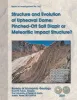
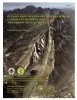
Publication Search

Bureau of Economic Geology Publications

Title Publication Year Sort ascending Abstract Author Publisher
Petrophysical characterization and distribution of remaining mobile oil:  South Cowden Grayburg Reservoir, Ector County, Texas Petrophysical characterization and distribution of remaining mobile oil: South Cowden Grayburg Reservoir, Ector County, Texas 2000

This report uses the rock fabric method to construct a reservoir model of a Permian Basin Grayburg dolomite reservoir. Rock fabrics are related to porosity, permeability, and capillary pressure and are distributed within a sequence stratigraphic framework.

Lucia, F.J. Bureau of Economic Geology
Relationship between arid geomorphic settings and unsaturated zone flow:  case study, Chihuahuan desert, Texas Relationship between arid geomorphic settings and unsaturated zone flow: case study, Chihuahuan desert, Texas 2000

Because geomorphic features can readily be mapped, our ability to characterize unsaturated flow over large areas would be greatly enhanced if relationships between geomorphic settings and unsaturated flow could be identified.

Scanlon, B.R., Goldsmith, R.S., Langford, R.P. Bureau of Economic Geology
Regional stratigraphic cross sections, Comanche Cretaceous (Fredericksburg - Washita Division), Edwards and Stockton plateaus, West Texas:  interpretation of sedimentary facies, depositional cycles, and tectonics Regional stratigraphic cross sections, Comanche Cretaceous (Fredericksburg - Washita Division), Edwards and Stockton plateaus, West Texas: interpretation of sedimentary facies, depositional cycles, and tectonics 2000

Six interlocking regional stratigraphic cross sections of Lower Cretaceous strata (middle Albian-lower Cenomanian) of the Edwards and Stockton Plateaus of West Texas illustrate the vertical and lateral extent of lithostratigraphic units and distribution of facies and facies tracts.

Smith, C.I., Brown, J.B., Lozo, F.E. Bureau of Economic Geology
Down to earth at Tuff Canyon, Big Bend National Park, Texas Down to earth at Tuff Canyon, Big Bend National Park, Texas 2000

Written for a nontechnical audience, this guide describes the Tuff Canyon area in detail and includes a glossary of terms that might be unfamiliar to non-geologists. Color photographs and sketches depict the geologic features, fauna, and flora of this part of Big Bend National Park.

Barker, D.S. Bureau of Economic Geology
Geologic map of the Blanco Lake quadrangle, Texas Geologic map of the Blanco Lake quadrangle, Texas 2000 Collins, E.W. Bureau of Economic Geology
Vegetation/Cover Types of Texas Vegetation/Cover Types of Texas 2000 Frye, R.G., Brown, K.L., McMahan, C.A. Bureau of Economic Geology
Geologic map of the Bastrop quadrangle, Texas Geologic map of the Bastrop quadrangle, Texas 2000 Collins, E.W. Bureau of Economic Geology
Geologic map of the Bastrop SW quadrangle, Texas Geologic map of the Bastrop SW quadrangle, Texas 2000 Collins, E.W. Bureau of Economic Geology
Geologic map of the Coupland quadrangle, Texas Geologic map of the Coupland quadrangle, Texas 2000 Collins, E.W. Bureau of Economic Geology
Geologic map of the Trio quadrangle, Texas Geologic map of the Trio quadrangle, Texas 2000 Collins, E.W. Bureau of Economic Geology