Bureau of Economic Geology Publications
| Title | Publication Year Sort ascending | Abstract | Author | Publisher | |
|---|---|---|---|---|---|
|
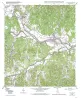
Geologic map of the Center Point quadrangle, Texas | 2004 | Collins, E.W. | Bureau of Economic Geology | |
|
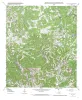
Geologic map of the Echo Hill Ranch quadrangle, Texas | 2004 | Collins, E.W. | Bureau of Economic Geology | |
|
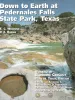
Down to Earth at Pedernales Falls State Park, Texas | 2003 | This nontechnical guidebook describes seven trails that visitors can walk within Pedernales (Spanish for the "flint" found in the park area) State Park, near Johnson City, in the Hill Country of Texas. |
Wermund, E.G., Barnes, V.E. | Bureau of Economic Geology |
|
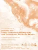
Jurassic and Lower Cretaceous Stratigraphy and Tectonics of Northeast Mexico | 2003 | From 1952 to 1956, Pemex conducted a considerable amount of stratigraphic field work in the eastern Sierra Madre and in Laramide folds to the north across the Sabinas Basin. |
Humphrey, W.E., Diaz, Teodoro, Wilson, J.L., Jordan, Clif | Bureau of Economic Geology |
|
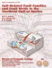
Salt-Related Fault Families and Fault Welds in the Northern Gulf of Mexico | 2003 | We classify salt-related faults and fault welds in the northern Gulf of Mexico on the basis of the three-dimensional geometry of the faults, welds, deformed strata, and associated salt bodies. |
Jackson, M.P.A., Rowan, M.G. | Bureau of Economic Geology |
|
Geologic map of the Seymour aquifer deposits, Vernon, Texas 30x60 minute quadrangle, Texas | 2003 | Collins, E.W. | Bureau of Economic Geology | |
|
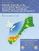
Hydraulic properties of the Carrizo-Wilcox aquifer in Texas: information for groundwater modeling, planning, and management | 2003 | Use of groundwater-flow models for prediction of future availability of water resources is standard practice. Having accurate hydraulic parameters for input into groundwater-flow models is critical to the generation of realistic local and regional water-resource management plans. |
Mace, R.E., Smyth, R.C. | Bureau of Economic Geology |
|
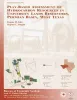
Play-based assessment of hydrocarbon resources in University Lands reservoirs, Permian Basin, West Texas | 2003 | Oil and gas resources on University Lands, 2.1 million acres in 19 West Texas counties, constitute a major asset of the University of Texas System. The original oil in place (OOIP) of the 102 major University Lands oil reservoirs is calculated to be 7,520 MMbbl. |
Kim, E.M., Ruppel, S.C. | Bureau of Economic Geology |
|
The Story of the Texas National Research Laboratory Commission and the Superconducting Super Collider: How Texas Won..and Lost | 2003 | "When in the early 1980’s it became known that the Federal Government was planning to undertake the construction of the massive Superconducting Super Collider (SSC) project, scientists in the various states, still without precise information on the criteria to be established for site selection, b |
Flawn, P.T. | Bureau of Economic Geology |

|
Rock-Fabric Petrophysical Classification of Carbonate Pore Space for Reservoir Characterization | 2003 | This color poster depicts the rock-fabric method for linking geologic descriptions with petrophysical properties. |
Lucia, F.J. | Bureau of Economic Geology |