Publication Details
Geolocation:
Get the Publication
$13.00
Abstract/Description:
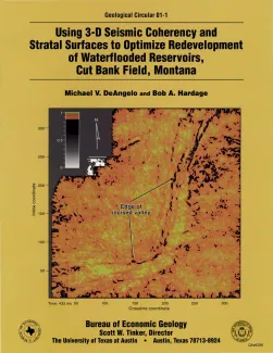
In a 3-D seismic survey, we acquired data over an 8-mi2 section of Cut Bank field, located on the west flank of Sweetgrass Arch in Glacier County, Montana. The main objective of the study was to improve the results of an ongoing waterflood program. The targeted reservoirs were an alluvial braided-stream system having a gross sand thickness of 20 to 25 ft. These reservoirs were deposited as incised-valley systems that are now at a depth of approximately 3,000 ft. Because clay plugging of abandoned channels is a major impediment to reservoir sweep, we thought that seismic-attribute analysis would help determine the aerial distributions of important facies within the reservoirs.
Traditional horizon-slice imaging of seismic reflection amplitudes suggested the presence of two possible incised-valley systems at two different depth intervals. Coherence analysis of reflection waveshapes more clearly defined these two incised-valley systems, and possibly three more, each at different depths.
We used an integrated interpretation approach to define these thinbedded fluvial channels laterally and vertically. We used coherence technology to identify the lateral extents of incised-valley systems, followed by stratal-surface interpretation techniques to determine the facies distributions within thin-bedded sequences deposited in these incised valleys.