
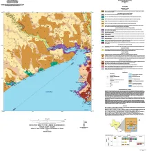
This 1:24,000-scale geologic map of the Lamar 7.5-minute quadrangle shows the distribution of unconsolidated to semiconsolidated Holocene and Pleistocene geologic units deposited on the Texas coastal plain in fluvial, deltaic, bay, estuarine, lagoonal, and Gulf-margin environments. The GeMS GIS database contains mapped lines and polygons representing geologic features, contacts, and geologic units. The database conforms to GeMS (Geologic Map Schema)--a standard format for the digital publication of geologic maps developed by the U.S.
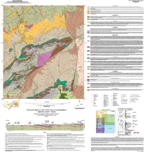
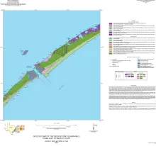
Aerial imagery used in this study included 0.6- and 1.0-m pixel, natural color, National Agriculture Imagery Program digital imagery photographed in 2020 and 2022. 1-m pixel 2020 imagery was obtained from the Texas Natural Resources Information System (TNRIS), and 0.6-m pixel 2022 imagery was obtained from the US National Resources Conservation Service. Imagery was supplemented by 1-m cell size digital elevation models (DEMs) constructed from data acquired during an airborne lidar survey flown by the US Geological Survey (USGS) in 2018.

A series of two 1:500,000 scale maps showing the Geothermal resources of South Texas.
Contents:
Vapor-Plume Deposits, K–Pg Boundary Outcrop in the Village of Armenia, Belize
David T. King, Jr. and Lucille W. Petruny
Facies Variability in Paleogeographic Trends from Core Data in the Lower and Middle Frio Formation in South Texas
Harold H. Rogers, III and William A. Ambrose