Aransas Pass Publications
| Title | Publication Year Sort ascending | Abstract | Author | Series | Publisher | |
|---|---|---|---|---|---|---|
|
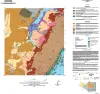
Geologic map of the Aransas Pass quadrangle, Texas Gulf coast | 2024 | This 1:24,000-scale geologic map of the Aransas Pass 7.5-minute quadrangle shows the distribution of unconsolidated to semiconsolidated Holocene and Pleistocene geologic units deposited on the Texas coastal plain in fluvial, deltaic, bay, estuarine, lagoonal, and Gulf-margin environments. |
Paine, J.G., Grunau, B.A., Morris, J.N. | Open-File Map | Bureau of Economic Geology |
|
Gulf of Mexico Shoreline Change, Mustang Island and North Padre Island, Texas: Northern Padre Island to Aransas Pass | 2021 | Caudle, T.L., Paine, J.G., Andrews, J.R., Suarez, J.R. | Posters | ||
|
Shoreline changes on Mustang Island and North Padre Island (Aransas Pass to Yarborough Pass) -- an analysis of historical changes of the Texas Gulf shoreline | 1977 | Historical monitoring along Mustang and north Padre Islands records the nature and magnitude of changes in position of the shoreline and vegetation line and provides insight into the factors affecting those changes. |
Morton, R.A., Pieper, M.J. | Geological Circular | Bureau of Economic Geology |
|
Shoreline changes on Matagorda Island and San Jose Island (Pass Cavallo to Aransas Pass) -- an analysis of historical changes of the Texas Gulf shoreline | 1976 | Historical monitoring along Matagorda Island and San Jose Island records the nature and magnitude of changes in position of the shoreline and vegetation line and provides insight into the factors affecting those changes. |
Morton, R.A., Pieper, M.J. | Geological Circular | Bureau of Economic Geology |