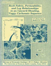
Permeability in a vuggy carbonate sequence can be related to particle size, separate-vug porosity, and interparticle porosity. Total porosity can be determined from neutron, acoustic, and density logs, but the distinction made between interparticle and separate-vug porosity using log responses has never been quantifiable. As a result, such distinction has never been integrated into permeability estimates drawn from log analysis.
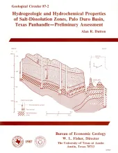
Ground water that moves downward from aquifers in clastic rocks of the Triassic Dockum Group and Neogene Ogallala Formation dissolves bedded halite and anhydrite in the Upper Permian evaporite section along the perimeter of the Southern High Plains in the Texas Panhandle. Ground-water velocity in salt-dissolution zones beneath the Canadian River valley and Rolling Plains may be greater than ground-water velocity in salt-dissolution zones beneath the Southern High Plains because of greater hydraulic conductivity and greater hydraulic-head gradient.
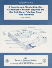
Permian strata in the Palo Duro Basin consist of multicyclic sequences of carbonate, nodular and laminated anhydrite, bedded halite, chaotic mudstone-halite, and terrigenous clastic sediments. These evaporite lithofacies record deposition in a shallow-water marine evaporate shelf depositional system. Clastic sediment derived from surrounding highlands contributed aluminous detritus to the basin, including aluminum-rich smectite, illite, and mixed-layer illite/smectite clays.
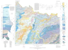
Geologic map that depicts the surface geology of Hardeman, Wilbarger, Wichita, Clay, Knox, Baylor, Archer, Haskell, Throckmorton, Young, and Foard Counties and part of Jack County, Texas. The 20-page booklet indicates geologic formations, abbreviations, and ages.
Changes in the position and stability of shorelines in the San Antonio Bay system (San Antonio, Espiritu Santo, and Mesquite Bays), Texas Gulf Coast, were documented using historical monitoring techniques.