Reports of Investigations
-
Books & Reports
- Reports of Investigations
- Guidebooks
- Udden Series
- Geological Circulars
- Down To Earth
- Atlases of Major Oil and Gas Reservoirs
- Texas Memorial Museum Publications
- Environmental Geologic Atlas of the Texas Coastal Zone
- Mineral Resource Circulars
- Other Reports
- Seminars and Workshops
- Handbooks
- Submerged Lands of Texas
- Symposia
- Annual Reports
- Open File Reports
-
Maps & Cross Sections
- Thematic Maps
- Miscellaneous Maps, Charts & Sections
- Geologic Atlas of Texas
- STATEMAP Project Maps
- Geologic Quadrangle Maps
- Cross Sections
- Highway Geology Map
- Energy and Mineral Resource Maps
- Shoreline Change and Other Posters
- Wilcox Group, East Texas, Geological / Hydrological Folios
- Bouguer Gravity Atlas of Texas
- River Basin Regional Studies
- Featured Maps
- Posters
- Teachers & the Public
-
Geological Society Publications
- Gulf Coast Association of Geological Societies
- Alabama Geological Society
- Austin Geological Society
- Corpus Christi Geological Society
- Houston Geological Society
- Lafayette Geological Society
- Mississippi Geological Society
- New Orleans Geological Society
- South Texas Geological Society
- GCS SEPM Publications
- Historic BEG & UT Series
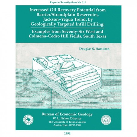
Increased Oil Recovery Potential from Barrier/Strandplain Reservoirs, Jackson-Yegua Trend
RI0217
For a downloadable, digital version: RI0217D.
RI0217. Increased Oil Recovery Potential from Barrier/Strandplain Reservoirs, Jackson-Yegua Trend, by Geologically Targeted Infill Drilling: Examples from Seventy-Six West and Colmena-Cedro Hill Fields, South Texas, by D. S. Hamilton. 52 p., 45 figs., 1994. Print.
To purchase this publication as a downloadable PDF, please order RI0217D.
ABSTRACT
The Jackson-Yegua Barrier/Strandplain Sandstone play is a prolific oil-producing trend in South Texas that has high average porosity (31 percent) and permeability (600 md). Nevertheless, it is characterized by low recovery efficiencies because of low average oil gravity, weak solution-gas drive, complex stratigraphy, and structural complications. In this study, the potential for substantial reserve growth was ascertained, and the remaining mobile oil resource contained within the internally heterogeneous and structurally disrupted sandstone reservoirs was targeted.
Two fields, Seventy-Six West and Colmena-Cedro Hill, were chosen as typical of the Jackson-Yegua Barrier/Strandplain Sandstone play. Detailed reservoir characterization of these fields indicated that the highly complex reservoir architecture consists of a mosaic of strike-oriented barrier-core, shoreface, and inner-shelf-shoal sandstones and mudstone-rich back-barrier-lagoonal deposits. The principal strike-oriented reservoir trend is crosscut by dip-oriented tidal-inlet fills and fluvial channels and has been modified by erosion and deposition of washover sandstones during storm events. Small-scale (10 to 100 ft) normal faults and dip reversal of units in the Jackson Group, forming in response to reactivation of older growth faults along the deeper Wilcox fault trend, have further disrupted reservoir continuity. The oil-trapping mechanism is primarily an updip permeability pinch-out where barrier sandstones thin against the muddy backbarrier-lagoonal facies. However, faulting and dip reversal played an important role in providing secondary structural traps.
At Seventy-Six West field, production trends are controlled by a complex geometry of reservoir sandstones and faults: eight discrete compartments were identified from the reservoir architecture, structure, and trends in oil and water production. At Colmena-Cedro Hill field, in contrast, structural control dominates production trends, whereas reservoir architecture is less important. Because Colmena-Cedro Hill field has an extensive gas cap and strong aquifer drive, subtle structural movement determines whether the reservoir sandstones lie within the gas-, oil-, or water-saturated parts of the field. Internal reservoir heterogeneity at Seventy-Six West and Colmena-Cedro Hill fields has created a strong fluid-flow anisotropy and, thus, the potential for bypassed mobile oil in untapped compartments and partly swept zones in waterflood areas targets for infill drilling and optimum waterflood design.
Four prospects were identified at Seventy-Six West field. Two have been drilled and successfully completed as oil producers. A third well was drilled primarily as a location for water injection in the geologically optimized waterflood currently being designed. Three prospects were identified at Colmena-Cedro Hill field, and to date, two have been drilled and successfully completed as oil producers, although one of the wells is considered only a marginal financial success. This case study of Seventy-Six West and Colmena-Cedro Hill fields can apply directly to all fields in the Jackson-Yegua Barrier/Strandplain Sandstone play, ultimately helping to increase oil recovery.
Keywords: barrier/strandplain reservoirs, Jackson Group, reservoir heterogeneity Jackson Group, reservoir heterogeneity
CONTENTS
Abstract
Introduction
Approaches to Identifying Reservoir Heterogeneity
Determining Reservoir Architecture
Establishing Fluid Flow in the Reservoir
Integrating Reservoir Architecture and Fluid-Flow Trends
Engineering Analysis
Regional Depositional Setting
Depositional Setting of Seventy-Six West and Colmena-Cedro Hill Fields
Regional Structural Setting
Seventy-Six West Field
Discovery and Development
Geologic Characterization
Reservoir Architecture
Cole C Sandstone
Cole B Sandstone
Summary
Architectural Controls on Production Patterns
Reservoir Compartments
Field Development Opportunities
Prospect 1
Prospect 2
Prospect 3
Prospect 4
Prospect 5
Colmena-Cedro Hill Field
Discovery and Development
Geologic Characterization
Reservoir Architecture
3rd Cole Sandstone
2d Cole Sandstone
1st Cole Sandstone
Architectural Controls on Production Trends
Field Development Opportunities
Prospect 1
Prospect 2
Prospect 3
Conclusions
Acknowledgments
References
Figures
1. Location map of oil fields of the Jackson-Yegua Barrier/Strandplain Sandstone play
2. Stratigraphic chart comparing temporal history of Gulf Coast Cenozoic depositional episodes
3. Depositional systems of the Jackson Group
4. East-west dip section A-A',South Texas strandplain-barrier-bar and associated depositional systems, Jackson Group
5. Structural setting of oil fields in the Jackson-Yegua Barrier/Strandplain Sandstone play
6. Seismic line illustrating structural style of Seventy-Six West field in dip section
7. Typical log at Seventy-Six West field showing oil-productive Cole B and C sandstones
8. Northwest-southeast cross section B-B' of Seventy-Six West field illustrating variability in log response of different reservoir facies that were deposited as barrier-island complex prograded and was subsequently transgressed
9. Structure map contoured on top of the Cole C sandstone
10. Net-sandstone map of Cole C, displaying two strike-oriented sandstone-rich trends interpreted as successive barrier-island complexes, each bounded updip by sand-poor areas
11. Map of SP log patterns of Cole C and interpretation of genetic facies associations
12. Sand-body geometry of modern Galveston and Matagorda barrier islands
13. Block diagram illustrating facies components of Cole C sandstone reservoir
14. Geomorphologic environments at Captain Sam's Inlet, South Carolina
15. Net-sandstone map of Cole B
16. Map of SP log patterns of Cole B and interpretation of genetic facies associations
17. Morphology of modern Central Padre barrier island in plan view and west-east cross section C-C' illustrating sand-body geometry and facies relationships
18. Block diagram of reservoir architecture at Seventy-Six West field
19. Contour map showing cumulative oil production from Cole C reservoir sandstone
20. Contour map showing cumulative oil production from Cole B reservoir sandstone
21. Contour map showing average daily oil production, Seventy-Six West field, 1990
22. Contour map showing average water cut for producing wells, Seventy-Six West field, 1990
23. Map of reservoir compartments at Seventy-Six West field
24. Production maps showing annual production of water from producing wells in southwest Seventy-Six West field during 1974, 1976, 1976, and 1980
25. Block diagram illustrating prospect 1 targeting an oil bank that may have moved ahead of injected water in the updip barrier-core facies of compartment 1
26. Prediction and result of reservoir characterization in well 62-11
27. SP and resistivity logs showing prospect 3 delineated from a flow-simulation study as an area that is inefficiently drained and targets barrier-core facies of compartment 3
28. Prediction and result of reservoir characterization in well 62-29
29. North-northwest-south-southeast cross section of Seventy-Six West field
30. Typical log at Colmena-Cedro Hill field showing oil-productive 1st, 2nd, and 3rd Cole sandstones
31. North-northwest-south-southeast cross section D-D' of Colmena-Cedro Hill field showing variability of SP log response within reservoir section
32. Structure map contoured on top of 1st Cole sandstone
33. Surface topography at Colmena-Cedro Hill field
34. Net-sandstone and SP-log-pattern map of 3rd Cole sandstone
35. Net-sandstone and SP-log-pattern map of 2nd Cole sandstone
36. Net-sandstone map of 1st Cole sandstone
37. Map of SP log patterns of 1st Cole sandstone and interpreted genetic facies associations
38. Production map illustrating cumulative oil production at Colmena-Cedro Hill field
39. Production map illustrating average daily oil production and average water cut from producing wells at Colmena-Cedro Hill field, 1990, and average water cut from producing wells at Colmena-Cedro Hill field, 1990
40. Contour map illustrating prospect 1, step-out well from L-24, targeting barrier-core facies of 3rd Cole sandstone
41. Northwest-southeast cross section E-E' of Cole sandstone illustrating infill-well potential of prospect 142 SP, resistivity, and RWA logs of step-out well no. 1
43. Contour map illustrating prospect 2 targeting remaining mobile oil in trend of highest historic production
44. West-east cross section F-F' of 1st Cole sandstone, which approximates depositional dip and illustrates en echelon arrangement of successive barrier ridges
45. Contour map illustrating prospect 3 targeting remaining mobile oil in trend of highest historic production
Citation
Hamilton, D. S., 1994, Increased Oil Recovery Potential from Barrier/Strandplain Reservoirs, Jackson-Yegua Trend, by Geologically Targeted Infill Drilling: Examples from Seventy-Six West and Colmena-Cedro Hill Fields, South Texas: The University of Texas at Austin, Bureau of Economic Geology, Report of Investigations No. 217, 52 p.


