Maps & Cross Sections
- Thematic Maps
- Miscellaneous Maps, Charts & Sections
- Geologic Atlas of Texas
- STATEMAP Project Maps
- Geologic Quadrangle Maps
- Cross Sections
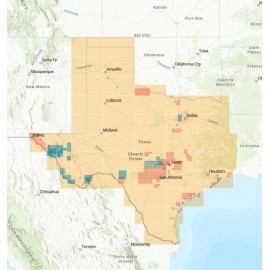
- Highway Geology Map
- Energy and Mineral Resource Maps
- Shoreline Change and Other Posters
- Wilcox Group, East Texas, Geological / Hydrological Folios
- Bouguer Gravity Atlas of Texas
- River Basin Regional Studies
- Featured Maps
Maps & Cross Sections
Maps & Cross Sections
Subcategories
-
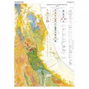
Thematic Maps
Page- and poster-size maps of Texas geology, tectonics, physiography, river basins, land resources, vegetation/cover types, aquifers, industrial minerals, soils, and ecoregions.
-
Miscellaneous Maps,...
Specialized maps and charts covering a wide variety of topics and areas including historic Texas geological maps, Enchanted Rock, Big Bend National Park, Lake Travis, and more.
-
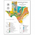
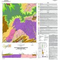
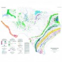
Geologic Atlas of Texas
In 1961, Dr. Virgil Barnes directed the creation of the Geologic Atlas of Texas, resulting in 38 geologic map sheets that cover the entire state of Texas. Available as folded paper maps in their traditional orange envelopes, and as downloadable PDFs.
-
STATEMAP Project Maps
Oversize, color geologic maps on a topographic base, scale 1:24,000, depicting various geologic quadrangles in Texas, with informal text booklet, 1990's to the present
-
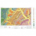
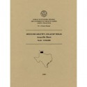
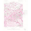
Geologic Quadrangle Maps
Maps at quadrangle scales depicting the surface geology of selected counties and areas in Texas, conducted between the 1950's-1988
-
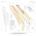
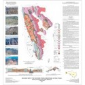
Cross Sections
Sets of cross sections through selected areas of Texas, with accompanying explanatory text booklets
-
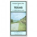
Highway Geology Map
Color, double-sided map, folded, showing Texas geology, major highway, and inset maps on selected topics. Published by AAPG, 1973.
-
Energy and Mineral...
Poster-sized color maps depicting areas of Texas containing energy, mineral, and geothermal resources
-

Shoreline Change and...
Posters showing shoreline change along the Gulf of Mexico
-
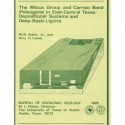
Wilcox Group, East...
Portfolios of maps, cross sections, and a text booklet depicting the geology and hydrology of the Wilcox Group in East Texas
-
Bouguer Gravity Atlas...
A series of 10 gravity maps centered around the Texas Panhandle. These folded transparent maps are at the same scale as their corresponding Geologic Atlas of Texas (GAT) sheet and can be superimposed on it to compare gravity information with surface geology.
-
River Basin Regional...
Two map sets of the Guadalupe-Lavaca-San Antonio-Nueces river basins areas depicting San Antonio East-Llano and Seguin West-Austin West map areas
-

Featured Maps
Some of our most popular maps.