Reports of Investigations
-
Books & Reports
- Reports of Investigations
- Guidebooks
- Udden Series
- Geological Circulars
- Down To Earth
- Atlases of Major Oil and Gas Reservoirs
- Texas Memorial Museum Publications
- Environmental Geologic Atlas of the Texas Coastal Zone
- Mineral Resource Circulars
- Other Reports
- Seminars and Workshops
- Handbooks
- Submerged Lands of Texas
- Symposia
- Annual Reports
- Open File Reports
-
Maps & Cross Sections
- Thematic Maps
- Miscellaneous Maps, Charts & Sections
- Geologic Atlas of Texas
- STATEMAP Project Maps
- Geologic Quadrangle Maps
- Cross Sections
- Highway Geology Map
- Energy and Mineral Resource Maps
- Shoreline Change and Other Posters
- Wilcox Group, East Texas, Geological / Hydrological Folios
- Bouguer Gravity Atlas of Texas
- River Basin Regional Studies
- Featured Maps
- Posters
- Teachers & the Public
-
Geological Society Publications
- Gulf Coast Association of Geological Societies
- Alabama Geological Society
- Austin Geological Society
- Corpus Christi Geological Society
- Houston Geological Society
- Lafayette Geological Society
- Mississippi Geological Society
- New Orleans Geological Society
- South Texas Geological Society
- GCS SEPM Publications
- Historic BEG & UT Series
Frio Formation of the Texas Gulf Coast Basin: Depositional Systems, Structural Framework, and Hydrocarbon Origin
RI0122
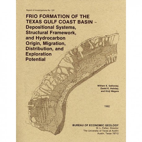
Frio Formation of the Texas Gulf Coast Basin--Depositional Systems, Structural Framework, and Hydrocarbon Origin, Migration, Distribution, and Exploration Potential, by W. E. Galloway, D. K. Hobday, and K. Magara, and others. 78 p., 76 figs., 15 tables, 19 plates, 1982. ISSN: 0082335X: Print Version.
A free, digital version of this publication can be found on: Texas ScholarWorks
RI0122. Frio Formation of the Texas Gulf Coast Basin--Depositional Systems, Structural Framework, and Hydrocarbon Origin, Migration, Distribution, and Exploration Potential, by W. E. Galloway, D. K. Hobday, and K. Magara, assisted by Diana Morton, Mark Helper, Victor Gavenda, and Nathan Smith. 78 p., 76 figs., 15 tables, 19 plates, 1982. ISSN: 0082335X: Print.
To purchase this publication as a downloadable PDF, please order RI0122D.
ABSTRACT
The Frio Formation is one of the major Tertiary progradational wedges of the Texas Gulf Coast Basin and has yielded nearly 6 billion bbl of oil and 60trillion ft30f gas. The Frio and its updip equivalent, the Catahoula Formation, consist of deposits of two large fluvial and associated deltaic systems centered in the Houston and Rio Grande Embayments. Structures in the Houston Embayment are dominated by syndepositional deformation of underlying Jurassic salt. Mobilization of thick, undercompacted prodelta and slope muds characterized the tectonic evolution of the deltaic sequence in the Rio Grande Embayment. These two major deltaic depocenters are separated by a vertically stacked, strike-parallel barrier and strandplain system.
Underlying, interbedded, and transgressive shelf, prodelta, and continental slope mudstone sequences provide principal source and sealing facies. Sparse organic geochemical data and regional thermal and compaction-history analyses show that large volumes of hydrocarbons have probably been generated within, and effectively expulsed upward and landward from, normally to moderately undercompacted sequences of these rnudstone facies.
All Frio depositional systems contain economically significant, geologically defined hydrocarbon producing plays. Volume, production style, and type of hydrocarbon within each of 10 recognized plays reflect source-rock quality and type, differing compaction and pore-fluid-migration history, and reservoir and trap configurations characteristic of each depositional system. Analysis of volumetric, historical, and geological relationships for production and discovery within each play provides a basis for estimating the undiscovered hydrocarbon resource potential as well as for assigning that potential to specific geographic and stratigraphic subdivisions of the depositional basin.
Keywords: Frio Formation, Gulf Coast Basin, hydrocarbons, oil and gas, Tertiary, Texas
CONTENTS
ABSTRACT
INTRODUCTION
Objectives
Methodology
GEOLOGIC FRAMEWORK
Stratigraphic correlation and relationships
Primary facies mapping
DEPOSITIONAL SYSTEMS
Gueydan fluvial system
Location and boundaries
Facies description
Structural style
Reservoir and trap configurations
Norias delta system
Location and boundaries
Facies description
Structural style
Reservoir and trap configurations
Chita/Corrigan fluvial system
Houston delta system
Location and boundaries
Facies description
Structural style
Reservoir and trap configurations
Buna strandplain/barrier system
Location and boundaries
Facies description
Structural style
Reservoir and trap configurations
Choke Canyon/Flatonia coastal lake/streamplain system
Greta/Carancahua barrier/strandplain system
Location and boundaries
Facies description
Structural style
Reservoir and trap configurations
Anahuac Shale wedge
Frio depositional history
Comparison of Frio and late Pleistocene paleogeography
Statistical characterization of facies assemblages
Thicknesses of sandstone and shale units
Number of sandstone and shale units
Sandstone percentage
Summary
HYDROCARBON SOURCE, MATURATION, MIGRATION, AND ENTRAPMENT
Concentration of organic carbon in shales
Maturation and expulsion of generated hydrocarbons
Effective hydrocarbon expulsion from source rocks
Expulsion and movement of compaction water and hydrocarbons
Source, reservoir, and primary migration
HYDROCARBON PRODUCTION
Play recognition and description
Play stratigraphy, structural relationships, and hydrocarbon production
EVALUATIONS OF REMAINING RESOURCE POTENTIAL
Historical approach
Cumulative number of exploratory wells
Cumulative footage of exploratory drilling
Discovery versus time
Comparative results
Volumetric approach
Source and migration potential approach
CONCLUSIONS
ACKNOWLEDGMENTS
REFERENCES
76 Figures
15 TABLES
1. Statistics (in feet) of sandstone-unit and shale-unit thickness
2. Number of sandstone (or shale) units normalized for 1,000-lt (300-m) intervals
3. Sandstone-percentage statistics
4. Defining geologic and exploration attributes of Frio MSU plays
5. Quantitative geologic attributes of Frio MSU plays
6. Hydrocarbon inventory for Frio MSU plays
7. Statistical summary of recoverable oil (cumulative-well-number method)
8. Statistical summary of recoverable gas (cumulative-well-number method)
9. Statistical summary of total number, footage, and average depth of exploratory wells, 1942-1977
10. Statistical summary of recoverable oil (cumulative-footage method)
11. Statistical summary of recoverable gas (cumulative-footage method)
12. Statistical summary of recoverable oil (discovery-versus-time method)
13. Statistical summary of recoverable gas (discovery-versus-time method)
14. Summary of estimates of future discoveries, Frio MSU, derived from historical projections
15. Volumetric estimations of undiscovered hydrocarbons in plays of the Frio MSU
19 PLATES (accompanying book)
1. Regional correlation sections and depositional subbasins
2. Top of Frio structure map
3. Frio MSU isopach map
4. Net-sandstone isolith map, upper Frio operational unit
5. Net-sandstone isolith map, middle Frio operational unit
6. Net-sandstone isolith map, lower Frio operational unit
7. Sandstone-percentage map, upper Frio operational unit
8. Sandstone-percentage map, middle Frio operational unit
9. Sandstone-percentage map, lower Frio operational unit
10. Log facies map, upper Frio operational unit
11. Log facies map, middle Frio operational unit
12. Log facies map, lower Frio operational unit
13. Frio depositional systems
14. Stratigraphic dip section 1-1'
15. Stratigraphic dip section 6-6'
16. Stratigraphic dip section 13-13'
17. Stratigraphic dip section 17-17'
18. Stratigraphic dip section 22-22'
19. Map of Frio petroleum fields and outline of plays
Citation
Galloway, W. E., Hobday, D. K., Magara, K., and others, 1982, Frio Formation of the Texas Gulf Coast Basin--Depositional Systems, Structural Framework, and Hydrocarbon Origin, Migration, Distribution, and Exploration Potential: The University of Texas at Austin, Bureau of Economic Geology, Report of Investigations No. 122, 78 p.
