Reports of Investigations
-
Books & Reports
- Reports of Investigations
- Guidebooks
- Udden Series
- Geological Circulars
- Down To Earth
- Atlases of Major Oil and Gas Reservoirs
- Texas Memorial Museum Publications
- Environmental Geologic Atlas of the Texas Coastal Zone
- Mineral Resource Circulars
- Other Reports
- Seminars and Workshops
- Handbooks
- Submerged Lands of Texas
- Symposia
- Annual Reports
- Open File Reports
-
Maps & Cross Sections
- Thematic Maps
- Miscellaneous Maps, Charts & Sections
- Geologic Atlas of Texas
- STATEMAP Project Maps
- Geologic Quadrangle Maps
- Cross Sections
- Highway Geology Map
- Energy and Mineral Resource Maps
- Shoreline Change and Other Posters
- Wilcox Group, East Texas, Geological / Hydrological Folios
- Bouguer Gravity Atlas of Texas
- River Basin Regional Studies
- Featured Maps
- Posters
- Teachers & the Public
-
Geological Society Publications
- Gulf Coast Association of Geological Societies
- Alabama Geological Society
- Austin Geological Society
- Corpus Christi Geological Society
- Houston Geological Society
- Lafayette Geological Society
- Mississippi Geological Society
- New Orleans Geological Society
- South Texas Geological Society
- GCS SEPM Publications
- Historic BEG & UT Series
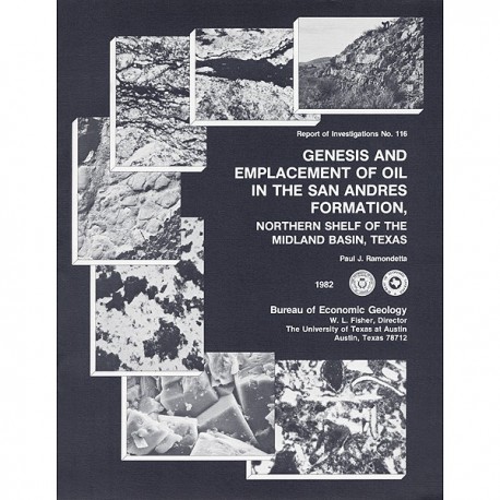
Genesis and Emplacement of Oil in the San Andres Formation, Northern Shelf of the Midland Basin, Texas
RI0116
Genesis and Emplacement of Oil in the San Andres Formation, Northern Shelf of the Midland Basin, Texas, by P. J. Ramondetta. 39 p., 28 figs., 7 tables, 1982. ISSN: 9982335X: Print Version.
A free, digital version of this publication can be found on: Texas ScholarWorks
RI0116. Genesis and Emplacement of Oil in the San Andres Formation, Northern Shelf of the Midland Basin, Texas, by P. J. Ramondetta. 39 p., 28 figs., 7 tables, 1982. ISSN: 9982335X: Print.
To purchase this publication as a downloadable PDF, please order RI0116D.
ABSTRACT
San Andres oil constitutes more than 80 percent of the total production from the Northern Shelf of the Midland Basin, Texas. The San Andres and Clear Fork carbonate rocks of the Northern Shelf contain sufficient amounts of lipid-rich organic material to rank them as potential petroleum source beds. Organic maturation of these rocks, as revealed from vitrinite reflectance and kerogen color, however, is not sufficient to have initiated catagenesis. Therefore, oil within Northern Shelf reservoirs was derived mostly from other sources.
San Andres oils have a common source, as evidenced by their remarkably uniform composition, which is revealed in liquid and gas chromatography, and Bartlesville Energy Technology Center (BETC) distillate analyses. Wolfcampian basinal clastics and dark argillaceous limestones of the northern Midland Basin are the most likely source rocks for this oil. Vertical expulsion of basinal oil through fractures into overlying shelf and shelf-margin carbonates has occurred along the Lower Permian Abo Reef trend. This reef hingeline is a narrow belt of shelf-margin buttresses ranging in age from Strawn to Clear Fork.
The trapping mechanism in the Northern Shelf is a combination of structural and facies control. Good reservoir conditions exist in San Andres strata that are draped and subsequently fractured over the subjacent shelf-margin buttress. Such fracturing should have enhanced conditions for development of secondary porosity during periods of subaerial exposure. Above the Abo Reef trend, a thick porous zone exists in the lower San Andres and upper Clear Fork Formations; shelfward, this porous zone grades into discrete porous layers resulting from cyclic sedimentation in shallow inner-shelf and sabkha environments. These Upper Permian carbonates tend to lose porosity in a northward (updip) direction, where conditions were more evaporitic. This updip change from porous to nonporous facies provides the porosity pinch-out in the vast Levelland - Slaughter - Cato trend of Texas and eastern New Mexico.
Late Cretaceous uplift in New Mexico exposed Permian strata, initiating a west-to-east flow of relatively fresh ground water. Passage of this meteoric water through San Andres and Clear Fork reservoirs caused downdip degradation and flushing of the oil. As a result of this ground-water movement, oil/water contacts tilt downdip 0.3° to 0.5°, and oil production is slightly offset downdip from local structural highs. The San Andres and Clear Fork oil was degraded by anaerobic sulfate reducing bacteria, which resulted in an enrichment of sulfur and light aromatics and a slight depletion of saturated hydrocarbons. This biodegradation progressively increases updip, as evidenced by higher sulfur contents and lower API gravity.
Keywords: San Andres, Northern Shelf, Clear Fork, Abo Reef, Midland Basin, oil and gas, Palo Duro Basin, Texas
CONTENTS
ABSTRACT
INTRODUCTION
METHODS
Total organic carbon
Type of organic matter
Kerogen color
Vitrinite reflectance
Analyses of extracted C1s+ organic matter
Gas chromatographic analysis of saturated C10+ hydrocarbons
Distillate analyses by Bartlesville Energy Technology Center
THE SAN ANDRES FORMATION-THE MAJOR PETROLEUM RESERVOIR OF THE NORTHERN SHELF
Cyclic sedimentation in the San Andres
Relationships among structure, facies, and porosity
SOURCE-ROCK POTENTIAL OF SAN ANDRES AND CLEAR FORK CARBONATES
Total organic carbon
Type of kerogen
Maximum burial temperature
Integration of kerogen data
Gas chromatographic analyses of the saturated C10+ organic extract
Conclusions concerning in situ generation of oil on the Northern Shelf
MIGRATION OF OIL FROM BASIN TO SHELF
Source-rock potential of Wolfcampian and Leonardian basinal deposits of the Midland Basin
Distribution of source-rock facies
Significance of the Abo Reef trend
Compositional relationships among oils of the Abo Reef trend
Sequence of oil migration from the northern Midland Basin
Oil migration south and west of the northern Midland Basin
SAN ANDRES OIL OF THE NORTHERN SHELF
Composition
DEGRADATION AND FLUSHING OF EMPLACED SAN ANDRES AND CLEAR FORK OILS
Biodegradation
Downdip flushing of San Andres oils
CONCLUSIONS
ACKNOWLEDGMENTS
REFERENCES
Figures
1. Map of study area showing San Andres oil production, shelf margins, and surface lineaments
2. Cross plot comparing geothermal diagenetic criteria
3. Gas chromatograph of C10+ saturated organic extract from Yellowhouse dolomite, DOE-Gruy Grabbe No. 1, Swisher County, Texas
4. Correlation index profiles of 10 San Andres and 1 Yeso oil, Northern Shelf
5. Average aromatic profiles of some principal oils in the Permian Basin
6. Facies tract, lower San Andres Formation, Northern Shelf
7. Plot of porosity versus permeability and resistivity log of Yellowhouse dolomite, Littlefield Northeast field, Lamb County, Texas
8. Wispy-laminated, burrowed, porous Yellowhouse dolomite, Atlantic Oil Ryan No. 1, Lamb County, Texas
9. Cross section of lower San Andres Formation, Northern Shelf, showing porosity relationships
10. Laminated, nonporous anhydrite/dolomite, lower San Andres Formation, Atlantic Oil Ryan No. 1, Lamb County, Texas
11. Banded salt, lower San Andres Formation, DOE-Gruy Grabbe No. 1, Swisher County, Texas
12. Structure map of the rr marker, Northern Shelf
13. Replacement of skeletal debris and voids by secondary anhydrite, Yellowhouse dolomite, Argonaut Energy (Crown Petroleum) Baumgart No. 1. Lamb County, Texas
14. Map of San Andres oil fields showing API gravity determinations, Northwestern Shelf, New Mexico
15. Structure map on the top of Yellowhouse dolomite, northern Hockley and southern Lamb Counties, Texas
16. Map of the study area showing sample locations for organo-geochemical analyses
17. Membranous plant debris (kerogen), Yellowhouse dolomite, Shell Mccary No. 1, Lamb County, Texas
18. Amorphous sapropel (kerogen), Wolfcampian basinal deposits, Lone Star Bragg No. 1, Lynn County, Texas
19. Concentrated organic matter adjacent to displacive nodules of anhydrite, Yellowhouse dolomite, southern Lamb County, Texas
20. Concentrated organic matter adjacent to displacive nodules of anhydrite, Yellowhouse dolomite, southern Lamb County, Texas
21. Concentrated organic matter adjacent to displacive nodules of anhydrite, Yellowhouse dolomite, southern Lamb County, Texas
22. Distribution of source-rock facies
23. Correlation index profiles for five oils, Abo Reef trend, eastern Wasson field,Gaines and Yoakum Counties, Texas
24. Aromatic profiles for four oils, Abo Reef trend, eastern Wasson field, Gaines and Yoakum Counties, Texas
25. Correlation index profiles for Wolfcamp and San Andres oil from multlpay Adair field, Terry County, Texas
26. Gas chromatographs of San Andres and Wichita-Albany oil, Abo Reef trend, eastern Wasson field, Gaines County, Texas
27. Ternary diagram of oils and extracts of study area
28. Percent sulfur versus depth of reservoir for various oils in study area
Tables
1. Stratigraphic chart, northern Midland Basin
2. General comparison of various geothermal alteration indices
3. Organo-geochemical analyses of San Andres and Clear Fork shelf carbonates
4. Organo-geochemical analyses of the Yellowhouse dolomite, Palo Duro Basin
5. Normalized paraffin distribution, Yellowhouse dolomite, Palo Duro Basin
6. Liquid and gas chromatographic analyses of various oils in the study area
7. General characteristics of principal oils in the Midland Basin
Citation
Ramondetta, P. J., 1982, Genesis and Emplacement of Oil in the San Andres Formation, Northern Shelf of the Midland Basin, Texas: The University of Texas at Austin, Bureau of Economic Geology Report of Investigations No. 116, 39 p.
