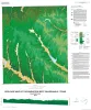
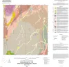
This colorful geologic map published by AAPG—developed with assistance from the Bureau of Economic Geology—highlights state and regional surface rock outcrops, detailing their age, depositional environments, rock types, and formation names.
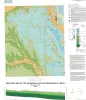
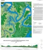
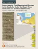
A thick (>6,000-ft [>1,830-m]) succession of Desmoinesian to Virgilian (Pennsylvanian) strata in the northwest part of the Anadarko Basin contains a variety of tide-modified deposits.