Many modern shore zones comprise a continuum of depositional environments that encompass both strandplain and barrier-island systems. Strandplains are further subdivided into two classes: sand-rich beach-ridge plains and mud-rich chenier plains. Tertiary shorezone systems of the Texas Gulf Coast Basin contain a significant proportion of the Texas oil resource in clastic reservoirs. These reservoirs display better-than-average oil recovery efficiencies.
The State-owned submerged lands of Texas encompass almost 6,000 mi2 (15,540 km2). They lie below waters of the bay-estuary-lagoon system and the Gulf of Mexico and extend 10.3 mi (16.6 km) seaward from the Gulf shoreline (fig. 1). The importance of these lands and their resources to resident flora and fauna as well as to people is well known and documented; more than one-third of the state's population is concentrated within an area of the Coastal Zone that is only about one-sixteenth of the state's land area.
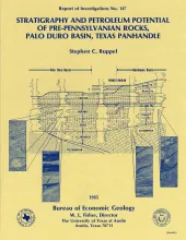
Pre-Pennsylvanian rocks in the Palo Duro Basin include (1) basal transgressive marine Cambrian(?) sandstones deposited over Precambrian basement, (2) overlying Lower Ordovician dolomites of the Ellenburger Group that formed when shallow seas covered much of the North American continent, and(3) Mississippian limestones and dolomites deposited when the area was inundated again after middle Paleozoic uplift and erosion. A generally similar stratigraphic sequence exists in the adjacent Dalhart and Hardeman Basins.
Salt dissolution has affected parts of the Upper Permian Salado, Seven Rivers, San Andres, Glorieta, and upper Clear Fork Formations beneath the Pecos River valley in eastern New Mexico and has been active beneath the Canadian River valley and the Rolling Plains of the Texas Panhandle. Extensive dissolution of the salts of the Salado and Seven Rivers Formations has also occurred beneath the Southern High Plains. Cumulative thickness of salt lost to dissolution exceeds 150 m (500 ft) along the western, northern, and eastern margins of the Palo Duro Basin.
Structural styles in the gravity-driven, ductile flow processes of glaciers and diapirs are analyzed. When dampened by rainfall, salt glaciers flow rapidly under minute differential stress. Thus, the concentration of water in diapiric rock salt is crucial to predicting creep rates in a repository medium. Natural-strain rates of rock salt range greatly from 10-8/s to 10-16/s; rates of average diapiric uplift are slowest.