Houston Publications
| Title | Publication Year Sort ascending | Abstract | Author | Series | Publisher | |
|---|---|---|---|---|---|---|
|
Submerged lands of Texas, Galveston - Houston area: sediments, geochemistry, benthic macroinvertebrates, and associated wetlands | 1985 | The State-owned submerged lands of Texas encompass almost 6,000 mi2 (15,540 km2). They lie below waters of the bay-estuary-lagoon system and the Gulf of Mexico and extend 10.3 mi (16.6 km) seaward from the Gulf shoreline (fig. 1). |
White, W.A., Calnan, T.R., Morton, R.A., Kimble, R.S., Littleton, T.G., McGowen, J.H., Nance, H.S., Schmedes, K.E. | Submerged Lands of Texas | Bureau of Economic Geology |
|
Hydrogeology of Gulf coast aquifers, Houston-Galveston area, Texas | 1977 | Aquifers in the Houston-Galveston area are composed principally of fluvial-deltaic sediments. The Alta Loma Sand is a complexly faulted, high-sand-percent unit that represents a seaward progression of fluvial, delta-plain, and delta-front facies. |
Kreitler, C.W., Guevara, E.H., Granata, G.E., McKalips, D.G. | Geological Circular | Bureau of Economic Geology |
|
Environmental geologic Atlas of the Texas coastal zone -- Galveston-Houston area | 1972 | The Texas Coastal Zone is marked by diversity in geography, resources, climate, and industry. |
Fisher, W.L., McGowen, J.H., Brown, L.F., Jr., Groat, C.G. | Environmental Geologic Atlas of the Texas Coastal Zone | Bureau of Economic Geology |
|
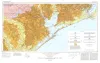
Geologic Atlas of Texas, Houston sheet (revised 1982) | 1968 | Geologic map that depicts the surface geology of Galveston and Chambers Counties and parts of Waller, Harris, Liberty, Jefferson, Orange, Brazoria, Matagorda, Wharton, and Fort Bend Counties. |
Barnes, V.E., Aronow, Saul, LeBlanc, R.J., Evans, F.G., Hinds, G.W., Holland, W.C., Van Siclen, D.C., Macon, J.W. | Geologic Atlas of Texas | Bureau of Economic Geology |