Reports of Investigations
-
Books & Reports
- Reports of Investigations
- Guidebooks
- Udden Series
- Geological Circulars
- Down To Earth
- Atlases of Major Oil and Gas Reservoirs
- Texas Memorial Museum Publications
- Environmental Geologic Atlas of the Texas Coastal Zone
- Mineral Resource Circulars
- Other Reports
- Seminars and Workshops
- Handbooks
- Submerged Lands of Texas
- Symposia
- Annual Reports
- Open File Reports
-
Maps & Cross Sections
- Thematic Maps
- Miscellaneous Maps, Charts & Sections
- Geologic Atlas of Texas
- STATEMAP Project Maps
- Geologic Quadrangle Maps
- Cross Sections
- Highway Geology Map
- Energy and Mineral Resource Maps
- Shoreline Change and Other Posters
- Wilcox Group, East Texas, Geological / Hydrological Folios
- Bouguer Gravity Atlas of Texas
- River Basin Regional Studies
- Featured Maps
- Posters
- Teachers & the Public
-
Geological Society Publications
- Gulf Coast Association of Geological Societies
- Alabama Geological Society
- Austin Geological Society
- Corpus Christi Geological Society
- Houston Geological Society
- Lafayette Geological Society
- Mississippi Geological Society
- New Orleans Geological Society
- South Texas Geological Society
- GCS SEPM Publications
- Historic BEG & UT Series
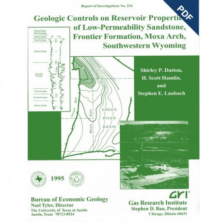
Geologic Controls on Reservoir Properties..., Frontier Formation, Moxa Arch...Wyoming. Digital Download
RI0234D
For a print version: RI0234.
RI0234D. Geologic Controls on Reservoir Properties of Low-Permeability Sandstone, Frontier Formation, Moxa Arch, Southwestern Wyoming, by S. P. Dutton, H. S. Hamlin, and S. E. Laubach. 89 p., 72 figs., 8 tables, 1995. doi.org/10.23867/RI0234D. Downloadable PDF.
To purchase this publication in book format, please order RI0234.
About This Publication
Authors of this report summarize the results of integrated geologic characterization of the Frontier Formation along the Moxa Arch in southwestern Wyoming in four major areas of study: (1) stratigraphic and depositional systems, (2) diagenesis of reservoir sandstones, (3) disttribution of natural fractures, and (4) horizontal stress orientation. The authors describe the geological elements that were found to be important in characterizing these low-permeability sandstone reservoirs. Research for this report was conducted on behalf of the Gas Research Institute.
ABSTRACT
The Upper Cretaceous Frontier Formation in Wyoming accounts for a significant portion of domestic tight gas production, reserves, and new completions. Tight reservoirs in the Frontier have produced more than 1 Tcf of gas, with most prolific production from the Moxa Arch in the westernGreen River Basin. Advanced technology will be needed to maximize gas recovery from the Frontier, and geologic characterization can contribute to understanding and efficiently developing these complex gas reservoirs. This report summarizes the results of integrated geologic characterization of the Frontier Formation along the Moxa Arch in southwestern Wyoming in four major areas of study: (1) stratigraphy and deposition systems, (2) diagenesis of reservoir sandstones, (3) distribution of natural fractures, and (4) horizontal stress orientation.
Along the Moxa Arch, the Frontier Formation was deposited in fluvial and wave-dominated deltaic systems. Within these systems, strike-aligned shoreface sandstone and dip-oriented fluvial channel-fill sandstone form the most important reservoirs. The Frontier is divided into several sandstone-bearing intervals; of these intervals, the Second Frontier sandstone contains the most prolific gas reservoirs. The Second Frontier is composed of several sandstone benches, of which the First and Second Benches are most widespread. The First Bench comprises laterally discontinuous fluvialchannel-fill sandstones, whereas the Second Bench is a single progradational shoreface sandstone having good lateral continuity. The main depositional and stratigraphic controls on distribution and quality of Frontier reservoirs are sandstone continuity and detrital clay content. On the La Barge Platform, Second Bench upper shoreface sandstones have the lowest detrital clay content and occur at the top of the laterally continuous shoreface sequence. Most Frontier wells on the La Barge Platform have Second Bench perforations, although variable thickness and diagenetic modification influence the productivity of individual wells. The First Bench contains numerous discontinuous fluvial channel-fill sandstones, each composed internally of a complex arrangement of clay-rich and clay-free zones. Reservoir quality in the First Bench is highly variable, although it improves southward along the Moxa Arch.
Diagenesis has overprinted depositional reservoir quality in these fine- to medium-grained litharenites and sublitharenites. Clean sandstones from all intervals contain an average of 1.6 percent primary intergranular porosity and 4.2 percent secondary porosity; microporosity averages 6.5 percent. Calcite, quartz, mixed-layer illite-smectite (MLIS), and illite are the most abundant cements. Authigenic MLIS clays consist of about 80 percent illite layers, suggesting that clays may be only moderately sensitive to fresh water. Low permeability in Frontier sandstones is caused by loss of porosity because of compaction, occlusion of pores by cements (particularly calcite and quartz), and lining of primary pores by fibrous illite and MLIS. Mean unstressed permeability to air is 0.19 md in upper shoreface sandstones (porosity = 14 percent), 0.13 md in fluvial channel-fill sandstones (porosity = 10 percent), and 0.08 md in lower shoreface sandstones (porosity = 13 percent).
Although natural fractures are sparse in Frontier Formation core, production and hydraulic fracture-treatment results suggest that fractures are important reservoir elements in the Frontier. Fracture networks in outcrops have wide spacing and great lateral extent, which would tend to make them effective fluid conduits but difficult to intersect and detect with vertical wells. The direction of fracture strike can shift by 90 degrees between adjacent beds. Moreover, fractures commonly are in discrete, irregularly spaced swarms separated laterally by domains that have few fractures, rather than in regularly spaced, orthogonal fracture sets. Strikes of some fracture sets can be explained as resulting from regional tectonic extension directions. More challenging to predict are fracture orientation in a specific bed and the probability of encountering a dense cluster of fractures with hydraulic fractures or horizontal wells.
Under typical reservoir conditions, the growth direction of hydraulic fractures parallels maximum horizontal stress (SHmax). The Green River Basin is in the Cordilleran east-west extension stressprovince but near the boundary with the east-northeast compressional midplate stress province. The boundaries between stress provinces are diffuse and may be characterized by transitional or inconsistent stress directions. Young north-striking normal faults along the western margin of the basin and borehole breakout data suggest east-west extension and approximately north-south-trending SHmax. In contrast, stress directions from some tests in the basin suggest an azimuth of 95" to 115' for the growth directions of hydraulic fractures in the Frontier Formation in the vicinity of the Moxa Arch. These directions are more consistent with the east-northeast SHmax direction of the nearby midplate stress province or growth of hydraulic fractures parallel to natural fractures.
Geologic studies of the Frontier Formation have demonstrated that geological controls play a critical role in gas producibility. This report summarizes the geological elements that have been found to be important in characterizing these low-permeability sandstone reservoirs.
Keywords: depositional systems, Frontier Formation, Green River Basin, maximum horizontal stress, Moxa Arch, natural fractures, natural gas resources, reservoir quality, sandstone diagenesis, stratigraphy, stress, tight gas sandstones, Wyoming
CONTENTS
Abstract
Introduction
Geologic Setting
Stratigraphy and Depositional Systems
Methods
Regional Stratigraphic Framework
Second Frontier Sandstone on the La Barge Platform
Sandstone Depositional Patterns
Clean Sandstone Distribution
Sandstone Porosity Maps
Second Bench Production Trends
Core Descriptions
Terra Resources Anderson Canyon No. 3-17
Wexpro Church Buttes No. 48
Enron South Hogsback No. 13-8A
S. A. Holditch & Associates SFE No. 4
Diagenesis of Frontier Sandstones
Methods
Frontier Composition
Grain Size and Sorting
Framework Grains
Matrix
Cements
Authigenic Clays
Quartz Overgrowths
Calcite
Porosity
Burial and Thermal History
Burial-History Curves
Thermal History
Interpretation of Diagenetic History
Controls on Reservoir Quality
Porosity
Permeability
Depositional Environment
Geographic Area
Comparison of Diagenesis in Three Frontier Wells
Natural Fractures
Natural Fractures in Core
Fracture Abundance in Core
Fracture Dimensions in Core
Petrography of Fracture-Filling Minerals
Fracture Orientations in Core
Natural Fractures in Outcrop
Setting of Frontier Formation Exposures
Dominant Fracture Directions
Style of Fracture Sets
Fracture Dimensions
Fracture Spacing
Fracture Patterns
Fracture Networks and Connectivity
Scaling Attributes and Clustering
Fracture Origins
Timing and Style of Fracturing
Predicting Subsurface Fracture Attributes
Natural Fracture Exploration Targets
Stress Directions
Results of Stress-Direction Measurements
Wellbore Breakouts
Petal-Centerline Fractures
Core Strain Recovery
Acoustic Anisotropy
Axial Point-Load Tests
Hydraulic Fracture Microseismic Monitoring
Interpretation of Stress Data
Inconsistent Stress Directions
Low Horizontal Stress Anisotropy
Stress Provinces
Summary of Stress-Direction Results
Conclusions
Acknowledgments
References
Figures
1. Structure map, contoured on top of Second Frontier sandstone, showing major structural elements of the western Green River Basin
2. Map of major Frontier fields along the Moxa Arch, western Green River Basin
3. Upper Cretaceous stratigraphy in the western Green River Basin
4. Generalized regional north-south cross section along the Moxa Arch showing thicknesses and structural attitudes of Upper Cretaceous and Tertiary formations
5. Typical gamma-ray-resistivity log, Frontier Formation, northern Moxa Arch
6. Regional north-south. gamma-ray-resistivity cross section along the Moxa Arch
7. Map showing thickness of sandstone in the Second Frontier along the Moxa Arch
8. Map showing thickness of sandstone in the Second and Third Benches of the Second Frontier on the La Barge Platform
9. Depositional models of prograding shoreface parasequences
10. Map showing thickness of sandstone in the First Bench of the Second Frontier on the La Barge Platform
11. Net clean sandstone map, Second Bench of the Second Frontier, La Barge Platform
12. Net clean sandstone map, First Bench of the Second Frontier, La Barge Platform
13. Northwest-southeast schematic cross section showing distribution of shaly sandstone and
clean sandstone in the lower Frontier interval, north La Barge Platform
14. Map showing net thickness of Second Bench sandstone having at least 15 percent log porosity, northwest part of the La Barge Platform
15. Map showing net thickness of Second Bench sandstone having at least 15 percent log porosity, southeast part of the La Barge Platform
16. Initial potential map of wells on the La Barge Platform having Second Bench perforations
17. Log responses and rock properties in core from the First and Second Benches of the Second Frontier. Terra Anderson Canyon No. 3-17 well, Fontenelle field
18. Log responses and core description. Wexpro Church Buttes No . 48 well. Church Buttes field
19, Structure map. contoured on top of Second Frontier. South Hogsback field, and showing location of Enron South Hogsback No. 13-8A well
20. West-east stratigraphic cross scction showing SP and resistivity logs from the Enron South Hogsback No. 13-8A well and the nearest offset wells
21. Thickness map of high-resistivity sandstone in the Second Bench of the Second Frontier, South Hogsback field
22. Thickness map of sandstone in the First Bench of the Second Frontier, South Hogsback field
23. Log responses and core description from the Fourth Bench of the Second Frontier,
Enron South Hogsback No. 13-8A well, South Hogsback field
24. Log responses and rock properties in core from the First. Second, and Third Benches of the Second Frontier. Enron South Hogsback No. 13-8A well, South Hogsback field
25. Structure map, contoured on top of Second Frontier, Chimney Butte and Tip Top fields, northeast La Barge Platform
26. Gamma-ray/resistivity log from the SFE No. 4 well showing Frontier sandstone zones and cored intervals
27. Southwest-northeast stratigraphic cross section showing logs from SFE No. 4 and offset wells, Chimney Butte and Tip Top fields
28. Log responses and rock properties in core from the Second and Third Frontier, SFE No. 4, Chimney Butte field
29. Compositional classification of First, Second, and Third Frontier sandstones
30. Compositional classification of Frontier sandstones by depositional environment
31. SEM photograph of illite tangentially oriented around a secondary pore; quartz crystals project into pore, Terra Anderson Canyon No. 3-17 well
32. SEM photograph of authigenic fibrous illite lining primary pore, Terra Anderson Canyon No. 3-17 well
33. SEM photograph of sheets of authigenic illite bridging a pore, Terra Anderson Canyon No. 3-17 well
34. SEM photograph of cluster of authigenic chlorite flakes, Wexpro Church Buttes No. 48 well
35. SEM photograph of quartz overgrowth engulfing illite and chlorite cement, Wexpro Church Buttes No. 48 well
36. SEM photograph of authigenic kaolinite within a secondary pore, Mobil Tip Top No. T7 1 X-6G-28N-113W well
37. Kaolinite cement volume in clean sandstones as a function of present burial depth
38. Quartz cement volume in clean sandstones as a function of present burial depth
39. SEM photograph of chert grain showing abundant microporosity, Terra Anderson Canyon No. 3-17 well
40. Close-up of surface of chert grain
41. Burial-history curves for the tops of the Second Frontier, Hilliard, Rock Springs, Ericson-Lance, and undifferentiated Tertiary in wells on the Moxa Arch and in the Green River Basin
42. Calcite cement volume in clean sandstones as a function of depth
43. Secondary porosity volume in clean sandstones as a function of depth
44. Estimated original feldspar volume of clean sandstones as a function of depth
45. Loci of possible water temperatures and oxygen isotopic compositions that could have precipitated Frontier calcite cement
46. Semi-log plot showing inverse relationship between total cement volume and porosimeter porosity in clean sandstones
47. Semi-log plot showing inverse relationship between calcite cement volume and porosimeter porosity in clean sandstones
48. Minus-cement porosity as a function of depth in clean sandstones
49. Log-log plot of porosimeter porosity versus stressed permeability in 422 sandstones
50. Fractures in core from five Frontier Formation wells in Green River Basin
51. Closely spaced vertical fractures in Frontier Formation core, Blue Rim Federal No. 1-30 well
52. Map showing stress directions detected in GRI Tight Gas Sands wells in the Green River Basin; natural fracture strikes in Frontier Formation core and selected outcrops are also shown
53. Strength anisotropy in Frontier Formation sandstones from the SFE No. 4 well
54. Map showing traces of vertical fractures on Frontier Formation sandstone bedding plane east of Kemmerer, Wyoming
55. Map showing traces of dominantly east-striking vertical fractures on east-dipping sandstone
bedding plane, Frontier Formation, north of Kemmerer, Wyoming
56. Schematic map showing traces of dominantly north-striking vertical fractures on sandstone
bedding plane, Frontier Formation, north of Kemmerer. Wyoming
57. Fracture strike versus fracture length. Frontier Formation sandstones
58. Histogram of fracture spacing in Frontier Formation outcrops, north of Kemmerer, Wyoming
59. Fractures in outcrop traverses in Frontier Formation and in Cretaceous Pictured Cliffs Sandstone and horizontal core from Cretaceous Cozzette Sandstone, Piceance Basin, Colorado
60. Fracture swarms in outcrop traverse. Frontier Formation
61. Fractures in outcrop traverses, Frontier Formation, from various locations north of Kemmerer, Wyoming
62. Map illustrating definition of constricted fracture terminations
63. Proportions of fracture-termination types in representative Frontier sandstone outcrop
64. Schematic maps of fracture traces, Frontier Formation sandstone, Kemmerer, Wyoming, showing contrasting fracture-network connectivity
65. Graph showing number of counting elements containing fracture traces versus inverse of length of counting element sides for Frontier and Pictured Cliffs maps
66. Map view of deformation fronts of various shapes and fracture strikes in adjacent foreland areas that may result from foreland lateral extension
67. Depth versus SHmax direction for the SFE No. 4 well by means of several techniques
68. Box plots of SHmaX for various stress-direction indicators in the Frontier Formation, SFE No. 4 well
69. Diagram illustrating the point-load apparatus
70. Disks of Frontier Formation core having anisotropic strength in axial point-load test
71. Direction of hydraulic fracture growth from circumferential microseismic monitoring
72. Generalized stress map of the western United States
Tables
1. Frontier cores used in this study
2. Average composition of Frontier sandstones by depositional environment
3. Semiquantitative X-ray diffraction mineralogy data
4. Characteristics of clean First, Second, and Third Bench Frontier sandstones in four areas along the Moxa Arch
5. Stratigraphic data used to construct burial-history curves
6. Calculated time-temperature indices and corresponding vitrinite-reflectance values
7. Petrographic data from pay zones of GRI cooperative wells
8. Data showing maximum horizontal compression direction, Frontier Formation, Green River Basin, Wyoming
Citation
Dutton, S. P., Hamlin, H. S., and Laubach, S. E., 1995, Geologic Controls on Reservoir Properties of Low-Permeability Sandstone, Frontier Formation, Moxa Arch, Southwestern Wyoming: The University of Texas at Austin, Bureau of Economic Geology, Report of Investigations No. 234, 89 p. doi.org/10.23867/RI0234D.
