Reports of Investigations
-
Books & Reports
- Reports of Investigations
- Guidebooks
- Udden Series
- Geological Circulars
- Down To Earth
- Atlases of Major Oil and Gas Reservoirs
- Texas Memorial Museum Publications
- Environmental Geologic Atlas of the Texas Coastal Zone
- Mineral Resource Circulars
- Other Reports
- Seminars and Workshops
- Handbooks
- Submerged Lands of Texas
- Symposia
- Annual Reports
- Open File Reports
-
Maps & Cross Sections
- Thematic Maps
- Miscellaneous Maps, Charts & Sections
- Geologic Atlas of Texas
- STATEMAP Project Maps
- Geologic Quadrangle Maps
- Cross Sections
- Highway Geology Map
- Energy and Mineral Resource Maps
- Shoreline Change and Other Posters
- Wilcox Group, East Texas, Geological / Hydrological Folios
- Bouguer Gravity Atlas of Texas
- River Basin Regional Studies
- Featured Maps
- Posters
- Teachers & the Public
-
Geological Society Publications
- Gulf Coast Association of Geological Societies
- Alabama Geological Society
- Austin Geological Society
- Corpus Christi Geological Society
- Houston Geological Society
- Lafayette Geological Society
- Mississippi Geological Society
- New Orleans Geological Society
- South Texas Geological Society
- GCS SEPM Publications
- Historic BEG & UT Series
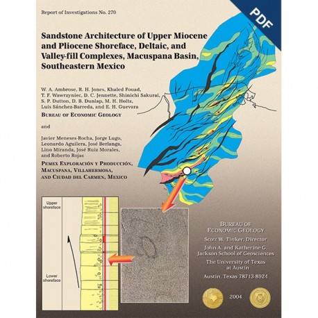
Sandstone Architecture of Upper Miocene and Pliocene Shoreface...Complexes, Macuspana Basin. Digital Download
RI0270D
For a print version: RI0270.
RI0270D. Sandstone Architecture of Upper Miocene and Pliocene Shoreface Deltaic and Valley-fill Complexes, Macuspana Basin, Southeastern Mexico, by W. A. Ambrose, R. H. Jones, K. Fouad, T. F. Wawrzyniec, D. C. Jennette, S. Sakurai, S. P. Dutton, D. B. Dunlap, M. H. Holtz, L. Sanchez-Barreda, and E. H. Guevara (BEG); J. Meneses-Rocha, J.Lugo, L. Aguilera, J.Berlanga, L. Miranda, J. Ruiz Morales, R. Rojas (PEMEX). 37 p., 24 figs., 2004. doi.org/10.23867/RI0270D.
To purchase this publication in book format, please order RI0270.
ABSTRACT
Upper Miocene and Pliocene shoreface and wave-dominated deltaic depocenters in the Macuspana Basin are related primarily to deep-sealed growth faults and large-scale rollover structures associated with shale evacuation. Early Neogene thrusting south of the basin triggered evacuation of Oligocene shale along northeast-down listric faults in the east and southeast basin margin. Episodic motion along these growth faults intermittently halted progradation of sandy shorezone systems and provided accommodation for thick (locally >500 m [>1,640 ft]) aggradational shoreface complexes with stacked successions of sandy upper-shoreface deposits.
Sediment accumulation rates, facies distribution, and sandbody stacking patterns in the Macuspana Basin were a function of base-level changes induced by tectonic activity, local subsidence in fault blocks, variations in sediment supply, and eustasy. Base-level change in the south end of the basin, caused by tectonic activity along the Chiapas Foldbelt, is inferred from upper and middle Miocene angular unconformities associated with more than 150 m (>492 ft) of missing section and deposition of (incised) valley-fill systems in narrow (commonly <5 km [<3 mi] wide) belts locally containing more than 100 m (>328 ft) of gross sandstone. Abrupt thickening of upper Miocene shoreface successions and stabilization of paleoshorelines along growth faults associated with significant withdrawal and northwestward expulsion of mobile Oligocene shale in the south-central part of the basin resulted in hundreds of meters of aggraded upper-shoreface deposits. Retrogradational successions above these thick, aggradational sandstones contain thin intervals of upward-thinning sandstones reflecting basinwide transgression. Sandstones in these retrogradational sections originated from transgressive winnowing of southeast-retreating shorelines. Modern analogs include the Santee Delta and Cape Romain in South Carolina, U.S.A., and the Grijalva Delta in Tabasco, Mexico.
A second-order, 5.0-m.y.a, flooding surface in the lower Pliocene defines the top of geopressure and serves as a regional reservoir seal for the main upper Miocene productive interval. Shales above this flooding surface, as much as 350 m (1,148 ft) thick, locally interfinger with lower Pliocene, highstand progradational successions that reach the westward margins of the basin. Early Pliocene valley-fill deposits in the basin are dominated by narrow, northwest-trending sandbodies. Gross-sandstone trends in these systems cut across fault trends, suggesting that accommodation for these deposits was provided by either sea-level fall or intermittent uplift from the Chiapas Foldbelt.
Keywords: accommodation, Chiapas Foldbelt, Gulf of Mexico, lithofacies, Macuspana Basin, Mexico, Miocene, Pliocene, sandstone architecture, shoreface, valley fill, wave-dominated delta
CONTENTS
ABSTRACT
RESUMEN [in Spanish]
INTRODUCTION
GEOLOGIC SETTING
DATABASE
STRUCTURAL SETTING
Listric Faults and Shale Diapirs
Structural Evolution
Phase 1: Early to Middle Miocene
Phase 2: Late Miocene/Pliocene
Phase 3: Pliocene to Recent
STRATIGRAPHY
LITHOFACIES AND ASSEMBLAGES
Shallow-Marine Assemblage
(1) Upward-Coarsening. Fine-Grained Sandstone with Ophiomorpha Burrows
Core Examples
(2) Fine- to Medium-Grained. Planar-Stratified Sandstone
Core Examples
(3) Upward-Fining, Fine-Grained Sandstone with Ophiomorpha Burrows
and Shelf Fragments
Depositional Environments
Marginal-Marine Assemblage
Core Example
Depositional Environments
Shelf Assemblage
(1) Upward-Coarsening, Very Fine Grained, Burrowed Silty Sandstone with
Small-Scale Ripples and Wavy Bedding
(2) Burrowed, Shelly, Calcareous Siltstone and Mudstone
Depositional Environments
Regressive-Transgressive Depositional Cycles
REGIONAL SANDBODY DISTRIBUTION
Upper Miocene
Sandbody Distribution
Log Facies
Interpretation
Transgressive Systems Tract
Sandbody Distribution
Interpretation
Lower Pliocene
Lower Pliocene Highstand Systems Tract
Gross Sandstone and Seismic Expression
Interpretation
Lower Pliocene Lowstand Systems Tract
Gross Sandstone
Interpretation
CONTROLS ON SANDBODY ARCHITECTURE AND RESERVOIR SEALS
Subsidence in Fault-Bounded Depocenters
Sequence-Stratigraphic Origin
Seals
CONCLUSIONS
ACKNOWLEDGMENTS
REFERENCES
Figures
1. Geologic setting of Macuspana Basin. showing main structural elements and main structural trends
2. Map of Macuspana Basin, showing well control, 3-D seismic surveys, 2-D seismic lines, and distribution of cores presented in this study
3. Southwest-northeast interpreted regional 2-D seismic line A-A' showing major Miocene and Pliocene listric fault, major deformation events, and stratigraphic horizons
4. Areas and timing of shale evacuation in Macuspana Basin
5. Shale diapirs in Costero 3-D survey
6. Stratigraphic summary of Miocene and Pliocene section in Macuspana Basin
7. East-west stratigraphic cross section C-C' in Chilapilla and Jose Colomo fields, showing log patterns and lateral continuity of upper Miocene and lower Pliocene section
8. Northwest-southeast log' cross section (D-D') of lower Pliocene valley-fill sandstones in UNC 1070 to FS interval in south part of basin
9. Gross-sandstone map of lower Pliocene valley-fill sandstones in interval from UNC 1070 to FS 1100
10. Southwest-northeast 2-D seismic section E-E,‘ showing seismic expression of lower Pliocene unconformities
11. Shoreface stacking patterns in aggradational, progradational, and transgressive settings
12. Core description of Chilapilla-98-D well from 3,028 to 3,034 m and photograph of fine- to medium-grained sandstone with Ophiomorpha burrow at 3,029.8 m
13. Core description of Vernet-601 core from 3,081 to 3,088.7 m
14. Core description of Chilapilla-98-D core from 2,972 to 2,979 m and photograph of laminated. fine-grained sandstone at 2,973.8 m
15. Galveston Island model. an analog for shallow-marine lithofacies assemblage in Macuspana Basin
16. Core description of Gabanudo-l core from 1,519 to 1,527 m; photograph of burrowed siltstone and very fine grained sandstone at 1,518.9 m; and pectin molds at 1,519.2 m
17. Core description of Akot-1 core from 2,090 to 2,098 m
18. Gross-sandstone map of upper part of upper Miocene stratigraphic interval (UNC 95 to FS 980)
19. Log facies map of upper part of upper Miocene stratigraphic interval (UNC 95 to FS 980)
20. Photograph of Santee Delta, South Carolina
21. Maximum amplitude map of upper part of upper Miocene sandy succession, showing series of parallel, strike-elongate amplitude trends
22. Gross-sandstone map of uppermost transgressive interval in upper part of upper Miocene (FS 800 to FS 980)
23. Cape Romain, a cuspate barrier island on modern coast of South Carolina, south of Santee Delta; muddy peat deposits exposed to eroding waves; and shell berm that will ultimately form part of a transgressive lag
24. Gross-sandstone map of basal highstand interval (FS 980 to UNC 990) in the lower Pliocene
Citation
Ambrose, W. A., Jones, R. H., Fouad, Khaled, and others, 2004, Sandstone Architecture of Upper Miocene and Pliocene Shoreface Deltaic and Valley-fill Complexes, Macuspana Basin, Southeastern Mexico: The University of Texas at Austin, Bureau of Economic Geology, Report of Investigations No. 270, 37 p. doi.org/10.23867/RI0270D.
