Reports of Investigations
-
Books & Reports
- Reports of Investigations
- Guidebooks
- Udden Series
- Geological Circulars
- Down To Earth
- Atlases of Major Oil and Gas Reservoirs
- Texas Memorial Museum Publications
- Environmental Geologic Atlas of the Texas Coastal Zone
- Mineral Resource Circulars
- Other Reports
- Seminars and Workshops
- Handbooks
- Submerged Lands of Texas
- Symposia
- Annual Reports
- Open File Reports
-
Maps & Cross Sections
- Thematic Maps
- Miscellaneous Maps, Charts & Sections
- Geologic Atlas of Texas
- STATEMAP Project Maps
- Geologic Quadrangle Maps
- Cross Sections
- Highway Geology Map
- Energy and Mineral Resource Maps
- Shoreline Change and Other Posters
- Wilcox Group, East Texas, Geological / Hydrological Folios
- Bouguer Gravity Atlas of Texas
- River Basin Regional Studies
- Featured Maps
- Posters
- Teachers & the Public
-
Geological Society Publications
- Gulf Coast Association of Geological Societies
- Alabama Geological Society
- Austin Geological Society
- Corpus Christi Geological Society
- Houston Geological Society
- Lafayette Geological Society
- Mississippi Geological Society
- New Orleans Geological Society
- South Texas Geological Society
- GCS SEPM Publications
- Historic BEG & UT Series
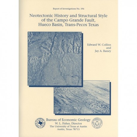
Neotectonic History and Structural Style of the Campo Grande Fault, Hueco Basin, Trans-Pecos Texas
RI0196
For a downloadable, digital version: RI0196D.
RI0196. Neotectonic History and Structural Style of the Campo Grande Fault, Hueco Basin, Trans-Pecos Texas, by E. W. Collins and J. A. Raney. 39 p., 16 figs., 5 tables, 1 appendix, 1990. ISSN: 0082335X: Print.
To purchase this publication as a downloadable PDF, please order RI0196D.
ABSTRACT
The Hueco Basin of Trans-Pecos Texas and Chihuahua, Mexico, formed in response to Basin and Range extensional tectonism that began about 24 Ma ago and continues to the present. The basin is curvilinear, with the northwestern part of the basin trending north to south and the southeastern part trending northwest to southeast. The Campo Grande fault is located in the southeastern part of the basin. Here the basin is asymmetrical, the thickest sediments having been deposited along the fault-bounded basin axis near the southwestern flank. Approximately 45 km long and striking northwestward, the Campo Grande fault is 4 to 12 km from the northeastern basin edge; it divides the downthrown, central part of the basin (>2,000 m of fill) from the shallower (175 m of fill) northeastern flank. Another major northwest-striking fault dips northeastward and bounds the southwestern basin margin in Mexico.
The Campo Grande fault is composed of en echelon fault strands that are 1.5 to 10 km long and have strikes of N25 to 7S0W. Dips are between 60 and 90 degrees southwest. Displacements decrease near terminations of strands. Grooves on fault planes indicate mostly dip-slip movement. Fault scarps have been modified by erosion of the footwall and deposition on the hanging wall. Erosion-resistant caliche (Stages IV to V) at the surface aids in preserving scarp heights of between 1.5 and 11.5 m and scarp slopes of 4 to 17 degrees.
Analysis of faulted upper Tertiary and Quaternary units indicates that successively younger units have less displacement. Maximum vertical offset measures 10 m across fault strands that cut the middle Pleistocene Madden Gravel (0.6 to 0.4 Ma old), which caps the Camp Rice Formation. Repeated arroyo incision and fluvial aggradation since the middle Pleistocene have developed Pleistocene terraces that are locally correlative and are mapped as parts of the regionally outcropping Ramey and Balluco Gravels.
Holocene terraces also occur. Maximum throws across fault strands that cut Ramey terraces (0.4 to 0.1 Ma old?) are 2.5 to 3m, but some Ramey deposits overlie fault strands and are not faulted. Offset of Balluco (0.1 to 0.025 Ma old?) and Holocene terraces has not been observed at fault strands that cut Ramey terraces. The average recurrence interval is 0.1 Ma (maximum), and the last faulting episode was late Pleistocene. On the downdropped block of one fault strand, faulted calcic horizons (0.5 to 1.0 m thick; Stage 111) with vertical separations of 1 to 2 m indicate at least five episodes of movement, deposition, and surface stabilization during the last 0.6 to 0.4 Ma. Maximum vertical offset during the last faulting event was about 1 to 1.5 m.
Keywords: Campo Grande fault, faults, fault scarps, Hueco Basin, neotectonics, Quaternary, Trans-Pecos Texas
CONTENTS
Abstract
Introduction
Methods
Previous Work
Tectonic Setting
Stratigraphy
Lower Cretaceous Units
Pliocene to Pleistocene Fort Hancock and Camp Rice Formations
Pleistocene Gravel Units
Holocene Alluvium and Windblown Sand
Fault Occurrence and Geometry
Scarp Morphology
Scarp Descriptions
Scarp of Fault Strand G
Excavations across Scarp of Fault Strand G
Scarp Morphology and Fault Age
Crosscutting Relationships between Stratigraphy and Faults
Fort Hancock-Camp Rice Contact and Faults
Madden Gravel and Faults
Ramey Gravel and Faults
Balluco Gravel and Faults
Alluvium and Faults
Calcic Horizons and Faults
Summary of Faulting History
Conclusions
Acknowledgments
References
Appendix A: Outcrop sketches of faults and fractures
Figures
- Regional map of surface Quaternary faults, Hueco Basin, and location of Campo Grande fault
- Map showing Campo Grande fault, study area, proposed waste repository site, locations of dated ash and carbonized material near the study area, and locations of selected stations
- Stratigraphy of the Hueco Basin study area and south-central New Mexico
- Cross section X-X' across Hueco Basin in the study area
- Lower hemisphere, equal-area plots of fault geometry data
- Photograph of chaotic folds in Camp Rice sand 14
- Diagrams of single-slope and compound-slope scarps and small difference between the amount of throw and vertical separation of a faulted unit
- Graph of scarp heights versus maximum scarp-slope angles 17
- Aerial photographs of scarp of fault strand
- Profile along scarp length of fault strand G
- Profiles of scarp of fault strand G
- Photograph of fault scarp along part of fault strand G
- Angular unconformity between Fort Hancock and Camp Rice Formations
- Photograph of offset Ramey Gravel and sketch of faults at excavation 35
- Photograph of offset Madden and Ramey Gravels and unfaulted Balluco Gravel and sketch of excavation 82
- Photograph of channel cut into Camp Rice Formation and filled with younger alluvium
Appendix Figures
A-1. Outcrop sketch of faults and fractures at station 44
A-2. Outcrop sketches of faults at stations 39 and 138
A-3. Outcrop sketch of fault at station 136
A-4. Outcrop sketches of faults at stations 117 and 139
Tables
- Types of data collected at selected stations
- Dated material at and near Campo Grande fault study area
- Morphometric data for scarps of Campo Grande fault strands
- Relationships between Quaternary units and faults
- Vertical separations between tops of youngest faulted calcic horizons and the possible "last-event" scarp, and between tops of overlying calcic horizons on the downthrown fault block
Plates (in back pocket of book)
1. Geologic map of Campo Grande fault, Hudspeth County, Texas
2a. Logs of excavations 8, 14, and 14a across Campo Grande fault, Hudspeth County, Texas
2b. Log of excavation 25 across Carnpo Grande fault, Hudspeth County, Texas
Citation
Collins, E. W., and Raney, J. A., 1990, Neotectonic History and Structural Style of the Campo Grande Fault, Hueco Basin, Trans-Pecos Texas: The University of Texas at Austin, Bureau of Economic Geology, Report of Investigations No. 196, 39 p.
