Reports of Investigations
-
Books & Reports
- Reports of Investigations
- Guidebooks
- Udden Series
- Geological Circulars
- Down To Earth
- Atlases of Major Oil and Gas Reservoirs
- Texas Memorial Museum Publications
- Environmental Geologic Atlas of the Texas Coastal Zone
- Mineral Resource Circulars
- Other Reports
- Seminars and Workshops
- Handbooks
- Submerged Lands of Texas
- Symposia
- Annual Reports
- Open File Reports
-
Maps & Cross Sections
- Thematic Maps
- Miscellaneous Maps, Charts & Sections
- Geologic Atlas of Texas
- STATEMAP Project Maps
- Geologic Quadrangle Maps
- Cross Sections
- Highway Geology Map
- Energy and Mineral Resource Maps
- Shoreline Change and Other Posters
- Wilcox Group, East Texas, Geological / Hydrological Folios
- Bouguer Gravity Atlas of Texas
- River Basin Regional Studies
- Featured Maps
- Posters
- Teachers & the Public
-
Geological Society Publications
- Gulf Coast Association of Geological Societies
- Alabama Geological Society
- Austin Geological Society
- Corpus Christi Geological Society
- Houston Geological Society
- Lafayette Geological Society
- Mississippi Geological Society
- New Orleans Geological Society
- South Texas Geological Society
- GCS SEPM Publications
- Historic BEG & UT Series
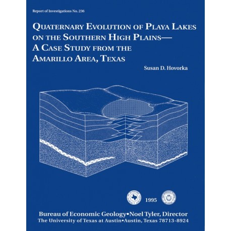
Quaternary Evolution of Playa Lakes on the Southern High Plains--A Case Study from the Amarillo Area, Texas
RI0236
For a downloadable, digital version: RI0236D.
RI0236. Quaternary Evolution of Playa Lakes on the Southern High Plains--A Case Study from the Amarillo Area, Texas, by S. D. Hovorka. 52 p., 40 figs., 3 tables, 1995. Print.
To purchase this publication as a downloadable PDF, please order RI0236D.
About This Publication
This report documents the stratigraphy beneath playa lakes and associated lake-margin, playa-basin, and upland settings. Genetic facies interpretation of the observed lithologies was undertaken to better predict the nature of interplaya stratigraphic variation and to extract information about the long-term geologic and paleoclimatic evolution of the area.
ABSTRACT
Playa lakes are abundant small ephemeral lakes (generally ~0.5 km in area) that occur in shallow depressions (generally <11 m deep) on the surface of the Southern High Plains. This study, based on analysis of excavations and 63 hollow-stem auger cores taken from 10 lake basins in the study area around the Pantex Plant northeast of Amarillo, Texas, resolves longstanding controversies regarding origin, evolution, and recharge behavior of playa lakes.
Origin of playa lakes has been debated for decades because the lakes are abundant and the processes that form them obscure. All of the lake basins studied have had a long history, originating as topographic lows before or during the early phases of Blackwater Draw deposition. The origin of some topographic lows can be related to dissolution of underlying Permian salt beds. Other basins appear to have been formed by other geomorphic processes. Stacked depositional cycles identified in lake sediments record repeated phases of (1) initial highstand, (2) ephemeral lake conditions, and (3) lake shrinkage and prolonged subaerial exposure. Although sedimentary structures show that the lakes were ephemeral during all phases, duration and frequency of flooding varied, thus changing relative amounts of sediment accumulation, deflation, and soil formation.
Playa lake basins in the study area contain 5 to 18 m of Quaternary lake sediments, including gray clays, oxidized red-brown clays, heterogeneous lacustrine delta deposits, fine lacustrine-eolian sand and silt beds and laminae, and admixed sand and clay. Lake sediments interfinger with calcic soils and red-brown loam of the Blackwater Draw Formation near the edges of the playas. As many as 12 calcic soil horizons are identified in the Blackwater Draw Formation in the upland. A sand unit underlies both playas and uplands at depths of 10 to 20 m.
Although the ephemerally ponded playa lakes are floored by clay soils, ground-water and unsaturated zone investigations show that playa lakes serve as sites of focused recharge. Description of a spectrum of playa basins of various sizes and recharge behaviors documents the long-term maintenance of the seasonally ephemeral lakes and their responses to past climatic changes. All of the lakes are underlain by thick but laterally and vertically heterogeneous clay sections. However, evidence of preferential pathways controlling flow is abundant beneath playas, including shrink-swell cracks and roots in clay soils and gleying, illuviated clay, leached carbonate, or mineralized fractures in older sediments. Sand interbeds within the lacustrine deposits may also influence flow rates. Vertical fractures served as conduits for both oxidizing and reducing fluids in high-permeability, well-sorted sands, as well as in low-permeability sediments.
The observed lateral and vertical heterogeneity within, and the range of variation among, playas can be used to constrain assumptions that will be made about subsurface stratigraphy of the playas at the Pantex Plant. Preferential pathways similar to those observed in all the studied playas can also be inferred to influence recharge behavior at the plant.
Keywords: Ogallala recharge, playa lakes, Quaternary climate, Texas
CONTENTS
Abstract
Introduction
Geologic Setting
Purpose of Study
Methods
Geomorphic Subdivisions of Playa Basins
Sediments within Playa Basins
Upland and Basin Slope Accretionary Eolian Facies
GPR Character
Trench Description
Genetic Facies Interpretation
Lacustrine Clays
Youngest Clays
Older, Gray Clays
Older, Reddish Clays
GPR Character
Trench Description
Genetic Facies Interpretation
Lacustrine-Eolian Sand Beds
Genetic Facies Interpretation
Lacustrine Delta Deposits
Genetic Facies Interpretation
Lower Fine to Medium Sand
Description
Correlation Problems
Geometry of Playa Basin Sediments
South Washington Street Playa
Coulter Street Playa
TDCJ Playa Basin
Dating
Wink Playa
Vance Playa
Sevenmile Basin
Bradshaw Playa
Finley Playa
SCS (Murrey) Playa
Origin, Evolution, and Recharge of Playas
Facies Relationships in Playa Basins
Inferred Distribution of Permeability in Playa Basins
Playa Basin Evolution Model
Cyclic Deposition of Playa Sediments
Origin of Playa Basins
Limits of Study
Conclusions
Acknowledgments
References
Figures
1. Location map of the Southern High Plains and geologic setting of the study area
2. Quaternary stratigraphy of the Southern High Plains
3. Location map of investigated playas and others in the area of the Pantex Plant
4. Detailed location map of TDCJ playa, along with the GPR survey line, trenches, and boreholes
5. Photos of typical appearance of Wink playa lake, north shoreline of Vance playa lake, floor of TDCJ playa, and eastern annulus of TDCJ playa
6. Soil map of TDCJ playa
7. Photos of playa shoreline features
8. Generalized playa stratigraphic section showing major facies
9. Photos of features typical of upland and basin slope eolian accretionary facies
10. Lithologic log of hollow-stem auger core from TDCJ playa and Borehole No. 1 and offset No. 1b
11. Segment of the GPR survey, in the upland east of TDCJ playa
12. Segment of the GPR survey, on the east slope of TDCJ playa basin
13. Segment of the trench in the slope setting on the east side of TDCJ playa basin, showing typical stratigraphy near station
14. Photos of representative sedimentary structures in surface lake clay
15. Photos of characteristics of lacustrine sediments in trenches
16. Photos of fine-grained lacustrine facies
17. Photos of fine-grained oxidized and gray lacustrine facies
18. Segment of the GPR survey
19. Lithologic log of hollow-stem auger core from TDCJ Borehole No. 3
20. Segment of trench 2 in the annulus setting at TDCJ playa. showing typical stratigraphy from the high-water mark down into the playa
21. Photos of features typical of the lacustrine-eolian sand facies
22. Photos of delta deposits
23. Photos of the lower fine to medium sand
24. Drawing from a photomosaic of east side of flood-control structure at South Washington Street playa, Amarillo
25. Photomosaic of west side of flood-control excavation at South Washington Street playa, Amarillo
26. Cross section showing geometry of sediments exposed on north side of flood-control excavation near Coulter Street, south Amarillo
27. North-south cross section A-A' of TDCJ playa
28. West-east cross section B-B' of the southern annulus of TDCJ playa
29. North-south cross section C-C' of TDCJ playa, showing relationships along the major drainage
30. Wink playa basin topographic map, showing well locations
31. North-south cross section D-D' of Wink playa basin
32. Vance playa basin topographic map, showing well locations
33. North-south cross section E-E' of Vance playa basin
34. Sevenmile Basin topographic map showing locations
35. West-east cross section F-F' of Sevenmile Basin
36. West-east cross section G-G' of Bradshaw playa
37. Finley playa basin topography and soils map
38. West-east cross section H-H' across Finley playa basin
39. Schematic cross section of facies relationships at the playa margin beneath the annulus, showing interrelationships among sediments deposited at various lake levels and emphasizing distribution of potential preferential pathways in playa sediments
40. Conceptual model of the evolution of playa basins, showing alternating episodes of lake expansion and lake shrinkage
Tables
1. Characteristics of playa basins examined during this study
2. Hollow-stem auger cores collected for playa studies
3. Radiocarbon analysis of soil samples from TDCJ playa
Citation
Hovorka, S. D., 1995, Quaternary Evolution of Playa Lakes on the Southern High Plains--A Case Study from the Amarillo Area, Texas: The University of Texas at Austin, Bureau of Economic Geology, Report of Investigations No. 236, 52 p.
