Reports of Investigations
-
Books & Reports
- Reports of Investigations
- Guidebooks
- Udden Series
- Geological Circulars
- Down To Earth
- Atlases of Major Oil and Gas Reservoirs
- Texas Memorial Museum Publications
- Environmental Geologic Atlas of the Texas Coastal Zone
- Mineral Resource Circulars
- Other Reports
- Seminars and Workshops
- Handbooks
- Submerged Lands of Texas
- Symposia
- Annual Reports
- Open File Reports
-
Maps & Cross Sections
- Thematic Maps
- Miscellaneous Maps, Charts & Sections
- Geologic Atlas of Texas
- STATEMAP Project Maps
- Geologic Quadrangle Maps
- Cross Sections
- Highway Geology Map
- Energy and Mineral Resource Maps
- Shoreline Change and Other Posters
- Wilcox Group, East Texas, Geological / Hydrological Folios
- Bouguer Gravity Atlas of Texas
- River Basin Regional Studies
- Featured Maps
- Posters
- Teachers & the Public
-
Geological Society Publications
- Gulf Coast Association of Geological Societies
- Alabama Geological Society
- Austin Geological Society
- Corpus Christi Geological Society
- Houston Geological Society
- Lafayette Geological Society
- Mississippi Geological Society
- New Orleans Geological Society
- South Texas Geological Society
- GCS SEPM Publications
- Historic BEG & UT Series
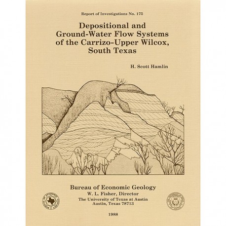
Depositional and Ground-Water Flow Systems of the Carrizo-Upper Wilcox, South Texas
RI0175
For a downloadable, digital version: RI0175D.
RI0175. Depositional and Ground-Water Flow Systems of the Carrizo-Upper Wilcox, South Texas, by H. S. Hamlin. 61 p., 47 figs., 9 tables, 3 appendices, 1988. ISSN: 008235X: Print.
To purchase this publication as a downloadable PDF, please order RI0175D.
ABSTRACT
In the Rio Grande Embayment of South Texas, the Carrizo Formation (lower Eocene) consists of two sand-rich fluvial depositional systems that grade basinward into several deltaic complexes within the upper part of the Wilcox Group. Data from oil, gas, and water wells provide information on Carrizo fluvial and ground-water flow systems, and outcrop and core data help define component lithofacies.
The bed-load channel system contains multistory, multilateral fluvial channel-fill sandstones deposited by broad, sand-rich, dominantly braided streams. Mudstones are mainly thin, laterally discontinuous remnants of abandoned channel fills. Bed-load channel sandstones are most abundant along the major fluvial axes and form the depositional framework of the interval. The mixed alluvial system consists of a more typical suite of coastal-plain facies, which were deposited by meandering streams in a variety of channel and interchannel environments. Mixed-load channel-fill sandstones tend to be isolated and surrounded by overbank mudstones and thin sandstones. Fluvial sediment input converged on the embayment from the west, northwest, and north.
The bed-load channel system is the Carrizo aquifer. Regional ground-water flow is controlled by topography, structural configuration, and, to a lesser extent, sandstone geometry. Rainfall recharges the aquifer at outcrop; ground water flows gravitationally down structural/depositional dip into the deeper subsurface, encounters updip-expulsing formation waters, partly mixes with them, and finally discharges upward, mainly along fault-related permeability pathways. Upward cross-formational leakage, driven by high fluid pressures, is common throughout much of the aquifer.
As Carrizo ground water moves down flow paths from outcrop, a systematic hydrochemical evolution occurs: total dissolved solids gradually increase, and calcium-sodium-bicarbonate-chloride water changes to sodium-bicarbonate water. Local hydrochemical anomalies can be related to variations in recharge characteristics, ground-water mixing, and aquifer lithology. The most important processes controlling hydrochemical evolution within the aquifer are calcite dissolution and cation exchange.
The updip Carrizo Sandstone contains fresh ground water, small oil fields, and uranium deposits. The downdip upper Wilcox trend is an area of active hydrocarbon exploration and production.
Keywords: Carrizo aquifer, Carrizo Formation, Eocene, fluvial sedimentation, ground-water flow, hydrochemistry, hydrogeology, Rio Grande Embayment, Texas, Wilcox Group
CONTENTS
ABSTRACT
INTRODUCTION
Methodology
Previous work
Regional geologic setting
FLUVIAL DEPOSITIONAL SYSTEMS
Sandstone distribution and geometry
Sediment input and dispersal patterns
Depositional systems and facies
Bed-load channel system
Mixed alluvial system
Paleogeography
Depositional history
Summary of depositional systems
GROUND-WATER FLOW SYSTEM
Hydrogeologic setting
Controls on ground-water flow
Hydrogeologic zonation
Physiography
Climate
Aquifer geology and hydraulic conductivity
Ground-water pumpage
Ground-water flow patterns
Potentiometric surface
Topographic effects
Geologic effects
Vertical components of flow
Summary of aquifer hydraulics
Hydrochemistry
Total dissolved solids
Hydrochemical facies
Sodium-bicarbonate water
Bicarbonate and pH
Chloride
Sulfate
Silica
Summary of hydrochemical evolution
ECONOMIC GEOLOGY
Ground water
Uranium
Petroleum
CONCLUSIONS
ACKNOWLEDGMENTS
REFERENCES
APPENDICES
A. Electric-log data base used in this study
B. Water-well data base used in this study
C. U.S. Geological Survey/Texas Water Commission ground-water reports
Figures
1. Structural elements of the Texas Coastal Plain
2. Generalized dip cross section down the axis of the Rio Grande Embayment
3. Location map of study area showing Carrizo Formation outcrop, surface and subsurface data control, cross-section lines, and location of type log
4. Structural cross section G-G' illustrating the Carrizo-upper Wilcox correlation interval
5. Map of water-well data control
6. Carrizo-upper Wilcox total-interval isopach map
7. Structure map on top of the Carrizo-upper Wilcox interval
8. Carrizo-upper Wilcox sandstone-percent map
9. Carrizo-upper Wilcox net-sandstone map
10. Carrizo-upper Wilcox maximum sand-body thickness map
11. Map of Carrizo-upper Wilcox high-sandstone trends, fluvial axes, and sediment input directions
12. Carrizo-upper Wilcox depositional systems, component facies, and type electric log
13. Geomorphic and sedimentary characteristics of bed-load, mixed-load, and suspended-load channel segments
14. Selected logs from dip cross section L-L' showing correlations and systems distributions along the northeastern fluvial axis
15. Selected logs from strike cross section 1-1' showing correlations, systems distributions, and fluvial axes
16. Selected logs from dip cross section G-G' showing correlations and systems distributions along the central fluvial axis
17. Selected logs from dip cross section C-C' showing correlations and systems distributions along the southwestern fluvial axis
18. Typical measured section in the bed-load channel depositional system illustrating the component facies and internal features of the thick, high-resistivity sand bodies
19. Typical measured section in the mixed alluvial depositional system illustrating the component facies and internal features of the interbedded sandstone/shale sequences
20. Paleogeographic reconstructions showing distributions of systems early, middle, and late in the depositional history of the Carrizo-upper Wilcox interval
21. Map of hydrogeologic zones that coincide with the fluvial axes shown in figure 11 but that also include adjacent interfluvial areas
22. Map showing topographic relief, major drainage, and locations of flowing Carrizo wells
23. Map of potentiometric surface, Carrizo aquifer
24. Structural cross section G-G' showing hydrogeologic features in profile
25. Structural cross section L-L' showing hydrogeologic features in profile
26. Graph showing relationship between land-surface (wellhead) elevation and water levels in the Carrizo aquifer
27. Numerically simulated, computer-generated flow net showing the effects of topography and hydraulic conductivity contrast on ground-water flow
28. Potentiometric-surface elevations in the Carrizo and Queen City aquifers in Frio and Atascosa Counties
29. Map of generalized ground-water flow patterns in the Carrizo aquifer
30. Map of total dissolved solids in Carrizo ground water
31. Graph of total dissolved solids versus depth in Carrizo ground water
32. Piper diagram of Carrizo ground-water chemistry
33. Map of hydrochemical facies in Carrizo ground water
34. Graph of sodium versus total dissolved carbonate in Carrizo ground water
35. Map of sodium percentage of total cation composition in Carrizo ground water
36. Graph of sodium versus calcium in Carrizo ground water
37. Map of pH in Carrizo ground water
38. Graph of pH versus bicarbonate in Carrizo ground water
39. Graph of bicarbonate versus depth in Carrizo ground water
40. Map of bicarbonate concentration in Carrizo ground water
41. Graph of sodium versus chloride in Carrizo ground water
42. Graph of chloride versus .depth in Carrizo ground water
43. Map of chloride concentration in Carrizo ground water
44. Graph of sulfate versus depth in Carrizo ground water
45. Map of sulfate concentration in Carrizo ground water
46. Map of dissolved silica in Carrizo ground water
47. Map of updip oil and gas production in the Carrizo-upper Wilcox interval showing structure and westward limit of Reklaw Shale
Tables
1. Paleocene to lower Eocene stratigraphic relationships in South Texas
2. Hydrogeologic properties of the Carrizo aquifer
3. Updip production from the Carrizo-upper Wilcox interval
Citation
Hamlin, H. S., 1988, Depositional and Ground-Water Flow Systems of the Carrizo-Upper Wilcox, South Texas: The University of Texas at Austin, Bureau of Economic Geology, Report of Investigations No. 175, 61 p.
