Bureau of Economic Geology Publications
| Title | Publication Year Sort ascending | Abstract | Author | Publisher | |
|---|---|---|---|---|---|
|
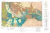
Geologic Atlas of Texas, Tucumcari sheet | 1983 | Geologic map that depicts the surface geology of Oldham County and parts of Hartley, Deaf Smith, Moore, Potter, and Randall Counties. |
Barnes, V.E., Eifler, G.K., Trauger, F.D., Spiegel, Z., Hawley, J.W., Dillon, R.L., Kottlowski, F.E., Hood, C. | Bureau of Economic Geology |
|
Oakwood salt dome, east Texas: geologic framework, growth history, and hydrocarbon production | 1983 | The top of mushroom-shaped Oakwood salt dome is approximately 210 m (700 ft) beneath the boundary of Freestone and Leon Counties near the southwestern end of the East Texas Basin, The dome is surrounded by Jurassic, Cretaceous, and lower Tertiary marine and nonrnarine strata. |
Giles, A.B., Wood, D.H. | Bureau of Economic Geology |
|
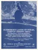
Submerged lands of Texas, Corpus Christi area: sediments, geochemistry, benthic macroinvertebrates, and associated wetlands | 1983 | The State-owned submerged lands of Texas encompass almost 6,000 mi2 (15,540 km2). They lie below waters of the bay-estuary-lagoon system and the Gulf of Mexico and extend 10.3 mi (16.6 km) seaward from the Gulf shoreline (fig. 1). |
White, W.A., Calnan, T.R., Morton, R.A., Kimble, R.S., Littleton, T.G., McGowen, J.H., Nance, H.S., Schmedes, K.E. | Bureau of Economic Geology |
|
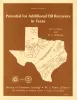
Potential for Additional Oil Recovery in Texas | 1983 | Texas has long been a major oil province, accounting for nearly 40 percent of the historic production of crude oil in the United States. Texas now holds less than 30 percent of the Nation's proven reserves and less than 15 percent of its estimated as-yet-undiscovered oil. |
Fisher, W.L., Galloway, W.E. | Bureau of Economic Geology |
|
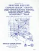
Regional aquifer characterization for deep-basin lignite mining, Sabine uplift area, northeast Texas | 1983 | Lignite deeper than 200 ft (61 m) constitutes about 60 percent of the total lignite resources in Texas. Projections indicate that meeting future demand will require mining this deep-basin lignite. |
Fogg, G.E., Kaiser, W.R., Ambrose, M.L., Macpherson, G.L. | Bureau of Economic Geology |
|
Geology and geohydrology of the Palo Duro basin, Texas panhandle -- a report on the progress of nuclear waste isolation feasibility studies (1982) | 1983 | Since early 1977, the Bureau of Economic Geology has been evaluating several salt-bearing basins within the State of Texas as part of the national nuclear waste repository program, The Bureau, a research unit of The University of Texas at Austin, is conducting a long-term program to gather and in |
Gustavson, T.C., Kreitler, C.W., Bassett, R.L., Budnik, R.T., Ruppel, S.C., Baumgardner, R.W., Jr., Caran, S.C., Collins, E.W. | Bureau of Economic Geology |
|
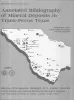
Annotated bibliography of mineral deposits in Trans-Pecos Texas | 1983 | Price, J.G., Henry, C.D., Standen, A.R. | Bureau of Economic Geology | |
|
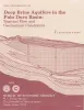
Deep brine aquifers in the Palo Duro basin: regional flow and geochemical constraints | 1983 | Geologic characterization of evaporite deposits as potential host rocks for burial of radioactive waste must include hydrogeologic investigations at both local and regional scales. |
Bassett, R.L., Bentley, M.E., Duncan, E.A. | Bureau of Economic Geology |
|
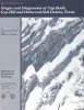
Origin and diagenesis of cap rock, Gyp Hill and Oakwood salt domes, Texas | 1983 | Petrographic and geochemical studies of caprock core from two salt domes, Gyp Hill in South Texas and Oakwood in East Texas, reveal the significantly different diagenetic histories of each dome. Cap rock on Gyp Hill is now forming within a shallow meteoric aquifer. |
Kreitler, C.W., Dutton, S.P. | Bureau of Economic Geology |
|
Continuity and Internal Properties of Gulf Coast Sandstones and Their Implications for Geopressured Fluid Production | 1983 | Continuity of sandstone reservoirs is controlled by various factors, including faults, sand-body geometry, and the distribution of framework grains, matrices, and interstices within the sand body. |
Morton, R.A., Ewing, T.E., Tyler, Noel | Bureau of Economic Geology |