Bureau of Economic Geology Publications
| Title | Publication Year Sort ascending | Abstract | Author | Publisher | |
|---|---|---|---|---|---|
|
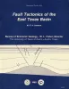
Fault tectonics of the east Texas basin | 1982 | Principal fault systems in the East Texas Basin were examined in terms of their distribution, geometry, displacement history, and possible origins. |
Jackson, M.P.A., Wilson, B.D. | Bureau of Economic Geology |

|
San Andreas carbonates in the Texas panhandle: sedimentation and diagenesis associated with magnesium-calcium-chloride brines | 1982 | The San Andres evaporitic sequence in the Palo Duro Basin comprises several thick carbonate units in its lower part and many thin units in its upperpart. To the south, across the Northern Shelf of the Midland Basin, evaporites pinch out and carbonates predominate. |
Bein, Amos, Land, L.S. | Bureau of Economic Geology |
|
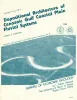
Depositional architecture of the Cenozoic Gulf coastal plain fluvial systems | 1982 | Galloway, W.E. | Bureau of Economic Geology | |
|
Frio Formation of the Texas Gulf Coast basin -- depositional systems, structural framework, and hydrocarbon origin, migration, distribution, and exploration potential | 1982 | The Frio Formation is one of the major Tertiary progradational wedges of the Texas Gulf Coast Basin and has yielded nearly 6 billion bbl of oil and 60trillion ft30f gas. |
Galloway, W.E., Hobday, D.K., Magara, Kinji | Bureau of Economic Geology |
|
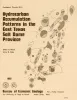
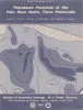
Hydrocarbon accumulation patterns in the east Texas salt dome province | 1982 | Mobilization of the Louann Salt created the present structural configuration in the central part of the East Texas Basin and was the major control on hydrocarbon accumulation in the area. Salt-cored anticlines, turtle-structure anticlines, and salt diapirs were produced by flow of salt. |
Wood, D.H., Giles, A.B. | Bureau of Economic Geology |
|
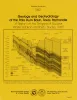
Petroleum potential of the Palo Duro basin, Texas panhandle | 1982 | The Palo Duro Basin seemingly has all the elements necessary for hydrocarbon generation and accumulation: reservoirs, traps, source rocks, and sufficient thermal maturity. Porous facies in pre-Pennsylvanian, Pennsylvanian, and Permian strata are potential hydrocarbon reservoirs. |
Dutton, S.P., Goldstein, A.G., Ruppel, S.C. | Bureau of Economic Geology |
|
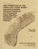
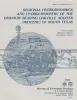
Geology and geohydrology of the Palo Duro basin, Texas panhandle -- a report on the progress of nuclear waste isolation feasibility studies (1981), annual report for period October 1, 1980 - September 30, 1981 | 1982 | Integrated study of the basin structure, tectonic history, rock physics, physical stratigraphy, hydrogeology, geochemistry, natural resources, and geomorphology of the Palo Duro and Dalhart Basins in the Texas Panhandle is part of a national evaluation of ancient salt basins as potential sites fo |
Gustavson, T.C., Bassett, R.L., Budnik, R.T., Finley, A.C., Goldstein, A.G., McGowen, J.H., Roedder, E., Ruppel, S.C. | Bureau of Economic Geology |
|
Regional hydrodynamics and hydrochemistry of the uranium-bearing Oakville aquifer (Miocene) of south Texas | 1982 | The Oakville Formation consists of sediments deposited by several major fluvial systems that traversed the Texas Coastal Plain during the Miocene Epoch. |
Smith, G.E., Galloway, W.E., Henry, C.D., Gluck, J.K., McIntyre, J.F., Pisasale, E.T., Spradlin, S.D. | Bureau of Economic Geology |
|
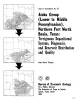
Atoka Group (Lower to Middle Pennsylvanian), northern Fort Worth basin, Texas: terrigenous depositional systems, diagenesis, and reservoir distribution and quality | 1982 | The Fort Worth Basin, in North-Central Texas, is a late Paleozoic foreland basin that was downwarped during the Early to Middle Pennsylvanian Period in response to tectonic stresses that also produced the Ouachita Thrust Belt. |
Thompson, D.M. | Bureau of Economic Geology |
|
Regional cross sections of the Texas panhandle: Precambrian to mid-Permian | 1981 | The Texas Panhandle traditionally has been an important source of mineral resources, especially petroleum, and resources will continue to contribute heavily to the economy of the area. The seven cross sections of this report synthesize the subsurface geology of the region. |
Handford, C.R., Dutton, S.P., Fredericks, P.E. | Bureau of Economic Geology |