Bureau of Economic Geology Publications
| Title | Publication Year Sort ascending | Abstract | Author | Publisher | |
|---|---|---|---|---|---|
|
Numerical modeling of regional ground-water flow in the deep-basin brine aquifer of the Palo Duro Basin, Texas panhandle | 1986 | A conceptual hydrogeologic model of the Palo Duro Basin, Texas Panhandle, subdivides the basin into three hydrogeologic units: (1) the shallow Ogallala and Dockum aquifers (Upper aquifer), (2) the Permian evaporite aquitard (Evaporite aquitard), and (3) the deep, confined, underpressured, princip |
Wirojanagud, Prakob, Kreitler, C.W., Smith, D.A. | Bureau of Economic Geology |

|
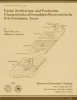
Geology and Ground-Water Hydrology of Deep-Basin Lignite in the Wilcox Group of East Texas | 1986 | Near-surface lignite resources in Texas, or those under less than 200 feet (61 m) of cover, are ample to meet the state's demand for lignite in this century. |
Kaiser, W.R., Ambrose, M.L. | Bureau of Economic Geology |
|
Recent Production Trends and Outlook for Future Oil and Gas Supplies in Texas | 1986 | Oil and gas production in Texas peaked in 1972, but the state still contributed 28 percent of oil production and 33 percent of gas production in the United States in 1984. |
Fisher, W.L., Finley, R.J. | Bureau of Economic Geology |
|
Hydrogeochemistry of the vadose zone in unmined and reclaimed deposits at Big Brown lignite mine, east Texas | 1986 | In the subsurface and at the outcrop, waters in argillaceous deposits of the Calvert Bluff Formation (lower Eocene, Wilcox Group) are brackish to saline. |
Dutton, A.R. | Bureau of Economic Geology |
|
Origin of silver-copper-lead deposits in red-bed sequences of Trans-Pecos Texas: Tertiary mineralization in Precambrian, Permian, and Cretaceous sandstones | 1985 | Silver deposits occur in Precambrian, Permian, and Cretaceous red-bed sequences near Van Horn, Texas. These deposits are geochemically similar and contain economically important quantities of silver, copper, and lead, as well as anomalously high amounts of arsenic, zinc, cadmium, and molybdenum. |
Price, J.G., Henry, C.D., Standen, A.R., Posey, J.S. | Bureau of Economic Geology |
|
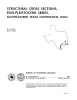
Structural cross sections, Miocene series, Texas continental shelf | 1985 | These cross sections numerically correspond to previously published onshore cross sections (CS0002--Dodge and Posey, 1981) and extend those sections across the continental shelf into the Miocene, a recent target of renewed petroleum exploration. |
Morton, R.A., Jirik, L.A., Foote, R.Q. | Bureau of Economic Geology |
|
Facies architecture and production characteristics of strand-plain reservoirs in the Frio Formation, Texas | 1985 | Many modern shore zones comprise a continuum of depositional environments that encompass both strandplain and barrier-island systems. Strandplains are further subdivided into two classes: sand-rich beach-ridge plains and mud-rich chenier plains. |
Tyler, Noel, Ambrose, W.A. | Bureau of Economic Geology |
|
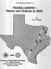
Texas lignite -- status and outlook to 2000 | 1985 | Kaiser, W.R., Sutley, A.M. | Bureau of Economic Geology | |
|
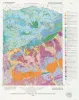
The Guadalupe - Lavaca - San Antonio - Nueces River basins regional study: San Antonio East - Llano East sheets | 1985 | Wermund, E.G., Gustavson, T.C., Garner, L.E., Morton, R.A., Woodruff, C.M., Jr., Macpherson, G.L., McKinney, L., Nilsson, J. | Bureau of Economic Geology | |
|
Stratigraphy and petroleum potential of pre-Pennsylvanian rocks, Palo Duro basin, Texas panhandle | 1985 | Pre-Pennsylvanian rocks in the Palo Duro Basin include (1) basal transgressive marine Cambrian(?) sandstones deposited over Precambrian basement, (2) overlying Lower Ordovician dolomites of the Ellenburger Group that formed when shallow seas covered much of the North American continent, and(3) Mi |
Ruppel, S.C. | Bureau of Economic Geology |