Publications by Fogg, G.E.
| Title | Publication Year Sort ascending | Abstract | Author | Series | Publisher | |
|---|---|---|---|---|---|---|
|
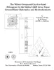
The Wilcox Group and Carrizo Sand (Paleogene) in the Sabine Uplift Area, Texas: Ground-water Hydraulics and Hydrochemistry | 1991 | Fogg, G.E., Kaiser, W.R., Ambrose, M.L., Prouty, D.A., Schultz, Susan | Geological Folios | Bureau of Economic Geology | |
|
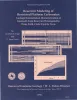
Reservoir Modeling of Restricted Platform Carbonates: Geologic/Geostatistical Characterization of Interwell-Scale Reservoir Heterogeneity, Dune Field, Crane County, Texas | 1990 | Petroleum reservoirs typically yield only a fraction of the oil initially in place because geologic heterogeneity causes incomplete drainage of oil. |
Fogg, G.E., Lucia, F.J. | Report of Investigations | Bureau of Economic Geology |
|
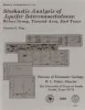
Stochastic analysis of aquifer interconnectedness: Wilcox Group, Trawick area, east Texas | 1989 | Detailed characterization of the spatial distribution of hydraulic conductivity (K) by direct measurement is usually impractical. |
Fogg, G.E. | Report of Investigations | Bureau of Economic Geology |
|
Effects of hydrostratigraphy and basin development on hydrodynamics of the Palo Duro Basin, Texas | 1987 | Deep brine aquifers of the Palo Duro Basin, Texas Panhandle, ranging in depth from about 1,000 to 3,000 m below land surface, are underpressured compared with the shallow Ogallala aquifer. |
Senger, R.K., Fogg, G.E., Kreitler, C.W. | Report of Investigations | Bureau of Economic Geology |
|
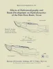
Characterization of the Grayburg Reservoir, university lands Dune field, Crane County, Texas | 1987 | San Andres and Grayburg reservoirs have yielded about 42 percent (9.8 billion barrels) of the total cumulative production of oil from the Permian Basin of West Texas. |
Bebout, D.G., Lucia, F.J., Hocott, C.R., Fogg, G.E., Vander Stoep, G.W., Harrington, K.L., Holtz, M.H., Leary, D.A. | Report of Investigations | Bureau of Economic Geology |
|
Regional aquifer characterization for deep-basin lignite mining, Sabine uplift area, northeast Texas | 1983 | Lignite deeper than 200 ft (61 m) constitutes about 60 percent of the total lignite resources in Texas. Projections indicate that meeting future demand will require mining this deep-basin lignite. |
Fogg, G.E., Kaiser, W.R., Ambrose, M.L., Macpherson, G.L. | Geological Circular | Bureau of Economic Geology |
|
Geology and geohydrology of the Palo Duro basin, Texas panhandle -- a report on the progress of nuclear waste isolation feasibility studies (1982) | 1983 | Since early 1977, the Bureau of Economic Geology has been evaluating several salt-bearing basins within the State of Texas as part of the national nuclear waste repository program, The Bureau, a research unit of The University of Texas at Austin, is conducting a long-term program to gather and in |
Gustavson, T.C., Kreitler, C.W., Bassett, R.L., Budnik, R.T., Ruppel, S.C., Baumgardner, R.W., Jr., Caran, S.C., Collins, E.W. | Geological Circular | Bureau of Economic Geology |
|
Three-dimensional ground-water modeling in depositional systems, Wilcox Group, Oakwood salt dome area, east Texas | 1983 | A three-dimensional model was constructed of ground-water flow in the Wilcox-Carrizo aquifer system near Oakwood salt dome to facilitate understanding the hydrogeology around salt domes of the Gulf interior region and ultimately to evaluate the hydrologic suitability of Oakwood Dome for storage o |
Fogg, G.E., Seni, S.J., Kreitler, C.W. | Report of Investigations | Bureau of Economic Geology |
|
Geology and geohydrology of the Palo Duro basin, Texas panhandle -- a report on the progress of nuclear waste isolation feasibility studies (1981), annual report for period October 1, 1980 - September 30, 1981 | 1982 | Integrated study of the basin structure, tectonic history, rock physics, physical stratigraphy, hydrogeology, geochemistry, natural resources, and geomorphology of the Palo Duro and Dalhart Basins in the Texas Panhandle is part of a national evaluation of ancient salt basins as potential sites fo |
Gustavson, T.C., Bassett, R.L., Budnik, R.T., Finley, A.C., Goldstein, A.G., McGowen, J.H., Roedder, E., Ruppel, S.C. | Geological Circular | Bureau of Economic Geology |
|
Ground-water hydraulics and hydrochemical facies in Eocene aquifers of the east Texas basin | 1982 | Eocene stratigraphic units in the East Texas Basin are composed of a thick sedimentary sequence (approximately 2,000 ft [600 m]) of fresh-water aquifers and aquitards covering an area of approximately 15,000 mi2 (51,000 km2). |
Fogg, G.E., Kreitler, C.W. | Report of Investigations | Bureau of Economic Geology |