Geological Circulars
-
Books & Reports
- Reports of Investigations
- Guidebooks
- Udden Series
- Geological Circulars
- Down To Earth
- Atlases of Major Oil and Gas Reservoirs
- Texas Memorial Museum Publications
- Environmental Geologic Atlas of the Texas Coastal Zone
- Mineral Resource Circulars
- Other Reports
- Seminars and Workshops
- Handbooks
- Submerged Lands of Texas
- Symposia
- Annual Reports
- Open File Reports
-
Maps & Cross Sections
- Thematic Maps
- Miscellaneous Maps, Charts & Sections
- Geologic Atlas of Texas
- STATEMAP Project Maps
- Geologic Quadrangle Maps
- Cross Sections
- Highway Geology Map
- Energy and Mineral Resource Maps
- Shoreline Change and Other Posters
- Wilcox Group, East Texas, Geological / Hydrological Folios
- Bouguer Gravity Atlas of Texas
- River Basin Regional Studies
- Featured Maps
- Posters
- Teachers & the Public
-
Geological Society Publications
- Gulf Coast Association of Geological Societies
- Alabama Geological Society
- Austin Geological Society
- Corpus Christi Geological Society
- Houston Geological Society
- Lafayette Geological Society
- Mississippi Geological Society
- New Orleans Geological Society
- South Texas Geological Society
- GCS SEPM Publications
- Historic BEG & UT Series
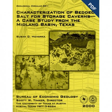
Characterization of Bedded Salt for Storage Caverns - A Case Study from the Midland Basin, Texas. Digital Download
GC0001D
For a print version: GC0001.
GC0001D. Characterization of Bedded Salt for Storage Caverns--A Case Study from the Midland Basin, Texas, by S. D. Hovorka. 80 p., 33 figs., 1 appendix, 2000. doi.org/10.23867/gc0001.
To purchase this publication in book format, please order GC0001.
About This Publication
This circular describes the geometry of the Salado salt in the Midland Basin of West Texas, one of the best-known sedimentary basins of the world. The author advocates using geologically based interpretation of depositional and dissolution processes as a tool for mapping the geometry of salt to assess the suitability of sites for developing solution-mined storage caverns such as have been used for disposal of oil-field wastes. Funding for this study was provided by the National Petroleum Technology Office of the U.S. Department of Energy.
ABSTRACT
The geometry of Permian bedded salt in the Midland Basin is a product of the interaction between depositional facies and postdepositional modification by salt dissolution. Interpretation of high-frequency cycle patterns in cross section and map view inferred from wireline logs documents the salt geometry. Geologically based interpretation of depositional and dissolution processes provides a powerful tool for mapping the geometry of salt to assess the suitability of sites for development of solution-mined storage caverns. In addition, this process-based description of salt geometry complements existing data about the evolution of one of the best-known sedimentary basins in the world and can serve as a genetic model to assist in interpreting other salt basins.
Solution-mined caverns in salt in the Midland Basin Salado Formation are low-cost, large-volume storage facilities used for chemical feedstock. Caverns are also created when salt is dissolved to produce sodium chloride brine for drilling mud and other applications. Recently, solution-mined caverns have been used for disposal of oil-field wastes. This log-based regional analysis of salt character provides basic descriptive information on the geometry of salt needed to site and regulate the development, use, and decommissioning of these facilities in the context of an exploration of facies relationships and implications for depositional history in this part of the Permian Basin.
Three regional trends are recognized in the Permian Salado Formation of the Midland Basin: (1) The thickest (700 ft of net salt) and most extensive salt units in the lower part of the Salado Formation show a strong and consistent regional thickening toward the southwest across the Central Basin Platform toward the Delaware Basin, reflecting accommodation resulting from subsidence in the Delaware Basin depocenter. Typical salt beds (10 to 30 ft thick) are interbedded with mudstone and mud-salt beds (3 to 10 ft thick). Anhydrite beds (2 to 30 ft thick) separate the salt-mudstone units into 5 to 10 intervals (50 to 350 ft thick). (2) Toward the upper part of the Salado Formation, salt beds are variable in thickness and discontinuous in lateral extent, and they pinch out toward the Midland Basin margins. This geometry is interpreted as the result of complex depositional patterns that developed toward the end of basin filling as well as salt dissolution beneath the sequence boundaries preceding and following Alibates deposition. (3) Salt beds have been thinned as a result of ongoing postdepositional dissolution toward the east structural margin of the Midland Basin where salt is near the surface.
Focused salt dissolution is noted in four areas: (1) over the structural high at the south end of the Central Basin Platform, (2) on the south side of the Howard-Glasscock high, (3) from both the top and the bottom of the Salado salt over the Capitan Reef rimming the Delaware Basin, and (4) over the southern Central Basin Platform structural high in the modern Pecos valley. This fourth relationship is attributed to localization of the drainage in depressions caused by enhanced salt dissolution where salt is at shallow depth.
Keywords: evaporite, Midland Basin, Permian Basin, Salado Formation, salt cavern, solution mining, Texas
CONTENTS
Abstract
Introduction
Purpose and scope of study
Methods
Previous work: geologic setting of the bedded salt in the Permian Basin
Regional geometry of bedded salt in the Midland Basin
Midland Basin stratigraphy
Delaware Basin stratigraphy
Stratigraphic cross sections: Midland Basin
Geometry of salt: Midland Basin
Evaluation of salt: processes
Depositional processes
Base-of-cycle dissolution
Post-Permian salt dissolution under burial conditions
Timing of salt dissolution under burial conditions
Case studies
Case study 1: Permian facies controls on salt thickness on the north margin of the Midland Basin
Case study 2: Post-Permian dissolution at a structural positive on the east basin margin
Case study 3: Post-Permian dissolution over the Central Basin Platform in the Pecos valley area
Case study 4: Post-Permian dissolution over the Capitan Reef
Applicability to site evaluation
Conclusions
Acknowledgments
References
Appendix 1. Wireline logs used for this study
Figures
1. Location map of salt in Texas and distribution of permitted salt caverns used for storage
2. Well and cross-section location map of the 31-county study area
3. Map showing study areas of previous studies
4. Map showing tectonic elements that controlled depositional facies and salt dissolution in the Midland Basin
5. Permian Basin stratigraphy, Leonardian through Quaternary, emphasizing units described in the text
6. Generalized geologic map of the study area, showing generalized sub crop patterns beneath surficial units
7. Type log through the Seven Rivers Formation
8. Type log through the Yates, Tansill, Salado, and Alibates Formations
9. Type logs through insoluble residues
10. Type log in the Delaware Basin
11. Conceptual correlation of Delaware Basin and Central Basin Platform units
12. North-south cross section of the Salado Formation and associated units in the Midland Basin
13. East-west cross section of the Salado Formation and associated units in the Midland Basin
14. Structure on top of the Salado salt-bearing interval
15. Thickness of interval containing Salado salt from the top of Ali bates Formation and equivalent top of upper Rustler anhydrite to top of Yates Formation and top of Lamar Limestone
16. Generalized depth to top of Salado salt-bearing interval from approximate land surface based on log datum and generalized 1:250,000-scale topographic maps to top of Alibates Formation
17. Map of Salado net salt and percent salt
18. Dissolution processes active in the salt-depositional environment
19. Halite dissolution in the depositional environment as a result of flooding
20. Halite dissolution in the depositional environment as a result of exposure
21. Dissolution at the bases of cycle or sequence
22. Wavy-laminated base-of-cycle insoluble residue
23. Cross section showing that top of salt forms a low-relief surface paralleling the regional hydrologic gradient
24. Salt-dissolution processes
25. Schematic diagram showing processes of formation of insoluble residue under conditions of regional low-angle salt dissolution and passive letdown of overlying strata
26. Typical textures diagnostic of insoluble residue formed under conditions of regional low-angle salt dissolution and passive letdown of overlying strata
27. Breccia interpreted as a result of formation and collapse of natural salt caverns
28. Detailed cross section between two closely spaced wells, in an area of complex salt dissolution
29. Detail of north-south stratigraphic cross section in the deep part of the northern Midland Basin showing salt-character changes controlled by Permian facies change and base of sequence dissolution
30. East-west structural cross section near the east edge of the Midland Basin showing salt-character changes controlled by post-Permian dissolution overprinted on Permian facies changes
31. North-south structural cross section across the Pecos valley and uplifted southern Central Basin Platform showing changes in salt character controlled by post-Permian dissolution
32. Detail of east-west stratigraphic cross section near the east edge of the Midland Basin showing salt-character changes controlled by post-Permian dissolution over the Capitan Reef trend
33. Map showing areas where abrupt salt-thickness changes are noted or potentially exist
Citation
Hovorka, S. D., 2000, Characterization of Bedded Salt for Storage Caverns--A Case Study from the Midland Basin, Texas: The University of Texas at Austin, Bureau of Economic Geology, Geological Circular 00-1, 80 p. doi.org/10.23867/gc0001.
