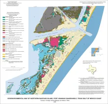
Publication Year
2006
Publisher
Series
Open-File Map
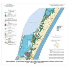
Publication Year
2006
Publisher
Series
Open-File Map
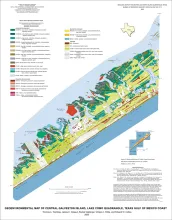
Publication Year
2006
Publisher
Series
Open-File Map
Publication Year
2005
Publisher
Series
Houston Geological Society
Publication Year
2005
Series
Gulf Coast Association of Geological Societies