Publication Year
2007
Publisher
Series
Open-File Map
Publication Year
2007
Publisher
Series
Miscellaneous Map
Publication Year
2007
Publisher
Series
Open-File Map
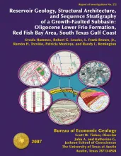
Publication Year
2007
Publisher
Series
Report of Investigations
Abstract
An integrated study using 3D seismic, wireline logs, and core analyses was conducted to establish new strategies for exploring compartmentalized, lowstand, prograding deltaic systems. The Frio siliciclastics, totaling approximately 11,000 ft, are commercial gas reservoirs in many of the growth-faulted, intraslope subbasins in South Texas. Red Fish Bay field is located in such a growth-faulted subbasin. Some Frio reservoir sandstones in Red Fish Bay field are part of a Frio third-order, lowstand prograding wedge tract.
Publication Year
2007
Publisher
Series
Open-File Map