STATEMAP Project Maps
-
Books & Reports
- Reports of Investigations
- Guidebooks
- Udden Series
- Geological Circulars
- Down To Earth
- Atlases of Major Oil and Gas Reservoirs
- Texas Memorial Museum Publications
- Environmental Geologic Atlas of the Texas Coastal Zone
- Mineral Resource Circulars
- Other Reports
- Seminars and Workshops
- Handbooks
- Submerged Lands of Texas
- Symposia
- Annual Reports
- Open File Reports
-
Maps & Cross Sections
- Thematic Maps
- Miscellaneous Maps, Charts & Sections
- Geologic Atlas of Texas
- STATEMAP Project Maps
- Geologic Quadrangle Maps
- Cross Sections
- Highway Geology Map
- Energy and Mineral Resource Maps
- Shoreline Change and Other Posters
- Wilcox Group, East Texas, Geological / Hydrological Folios
- Bouguer Gravity Atlas of Texas
- River Basin Regional Studies
- Featured Maps
- Posters
- Teachers & the Public
-
Geological Society Publications
- Gulf Coast Association of Geological Societies
- Alabama Geological Society
- Austin Geological Society
- Corpus Christi Geological Society
- Houston Geological Society
- Lafayette Geological Society
- Mississippi Geological Society
- New Orleans Geological Society
- South Texas Geological Society
- GCS SEPM Publications
- Historic BEG & UT Series


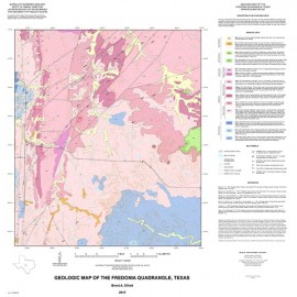
OFM0228. Geologic Map of the White Hills Quadrangle, Texas, by B. A. Elliott. Oversize geologic map on a color topographic base, map scale 1:24,000, 2016. Paper map. For downloadable PDF: OFM0228D.
About This Publication
This map is constructed for the study of F, REE, U/Th, and other mineral resources in the region. The map shows the distribution of geologic units north of the Big Bend National Park in the Christmas Mountains area, east of Highway 118 in the White Hills quadrangle. Geologic units were mapped, and structural measurements were taken in the field; where bedrock units are covered by surficial units and vegetation, or access is limited, units were interpreted using aerial imagery, soil data, well-drilling records, and previous mapping.
Keywords: maps, geologic maps, mineral resources, White Hills quadrangle, Texas
Citation
Elliott, B. A., 2016, Geologic Map of the White Hills Quadrangle, Texas: The University of Texas at Austin, Bureau of Economic Geology, Open-File Map No. 228, map scale 1:24,000.