Reports of Investigations
-
Books & Reports
- Reports of Investigations
- Guidebooks
- Udden Series
- Geological Circulars
- Down To Earth
- Atlases of Major Oil and Gas Reservoirs
- Texas Memorial Museum Publications
- Environmental Geologic Atlas of the Texas Coastal Zone
- Mineral Resource Circulars
- Other Reports
- Seminars and Workshops
- Handbooks
- Submerged Lands of Texas
- Symposia
- Annual Reports
- Open File Reports
-
Maps & Cross Sections
- Thematic Maps
- Miscellaneous Maps, Charts & Sections
- Geologic Atlas of Texas
- STATEMAP Project Maps
- Geologic Quadrangle Maps
- Cross Sections
- Highway Geology Map
- Energy and Mineral Resource Maps
- Shoreline Change and Other Posters
- Wilcox Group, East Texas, Geological / Hydrological Folios
- Bouguer Gravity Atlas of Texas
- River Basin Regional Studies
- Featured Maps
- Posters
- Teachers & the Public
-
Geological Society Publications
- Gulf Coast Association of Geological Societies
- Alabama Geological Society
- Austin Geological Society
- Corpus Christi Geological Society
- Houston Geological Society
- Lafayette Geological Society
- Mississippi Geological Society
- New Orleans Geological Society
- South Texas Geological Society
- GCS SEPM Publications
- Historic BEG & UT Series
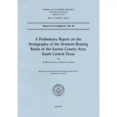
A Preliminary Report on the Stratigraphy of the Uranium-Bearing Rocks of the Karnes County Area, South-Central Texas
RI0030
A Preliminary Report on the Stratigraphy of the Uranium-Bearing Rocks of the Karnes County Area, South-Central Texas, by D. H. Eargle and J. L. Snider. 30 p., 5 figs., 1957. Prepared in cooperation with the U.S. Geological Survey. Print Version.
A free, digital version of this publication can be found on: Texas ScholarWorks
RI0030. A Preliminary Report on the Stratigraphy of the Uranium-Bearing Rocks of the Karnes County Area, South-Central Texas, by D. H. Eargle and J. L. Snider. 30 p., 5 figs., 1957. Prepared in cooperation with the U.S. Geological Survey. Print.
To purchase this publication as a downloadable PDF, please order RI0030D.
ABSTRACT
Uranium was discovered near Tordilla Hill in Karnes County, south-central Texas, in the fall of 1954, in the upper part of the Jackson formation of late Eocene age. By July 1955, 14 uranium prospects were reported as far northeast as Fayette County, northeast of Karnes County, and southwest to Duval County, south Texas, over a distance of about 190 miles. Uranium minerals or radioactive rocks have been found in tuffaceous sand, silt, or bentonitic clay in at least seven different stratigraphic positions ranging in age from late Eocene to Pliocene. The known radioactive materials occur in the Goliad sand of Pliocene age, the Oakville sandstone of Miocene age, and the Catahoula tuff of Miocene (?) age in Duval County; in theOakville sandstone and the upper 500 feet of the Jackson formation in Karnes County; and in the Catahoula tuff in Gonzales County. This paper presents the results of a preliminary investigation of the stratigraphy of the uranium-bearing formations through Karnes County and the adjoining counties to the southwest and of the correlation of the potentially uranium-producing beds in drill holes and surface exposures. During this study the following contacts were mapped in reconnaissance through the area: the base of the Oakville sandstone, the base of the Catahoula tuff, the base of the Frio clay (Oligocene?), and the base of the Jackson formation. All the formations strike northeastward in the region and dip southeastward toward the Gulf Coast. They are locally cut by a number of major and minor faults, trending generally parallel to the strike of the formations.
Uranium minerals have been found, to date [1957], generally no deeper than 30 feet below the surface, chiefly filling interstices between, and replacing, grains of sandstone that lie above impervious clay. Some of the clay also contains uranium minerals, generally as a coating along joint and bedding planes. The richest concentrations of uranium, however, are found in sand that has a clayey matrix. Some of the sand beds contain clay pebbles and small fragments of carbonaceous material.
Although detailed mineralogic studies have not been made, the following uranium minerals have been identified: autunite, carnotite, tyuyamunite, uranophane, and schoepite. Other epigenetic minerals such as pyrite, hematite, sphalerite, and ilsemannite are associated with the uranium minerals at one prospect near Tordilla Hill. Detrital minerals of the ore-bearing sandstones include many derived from igneous rock sources.
Keywords: Jackson Formation, Karnes County, Karnes uranium district, Tordilla Hill, tuff, uranium, mineral resources, Texas
Citation
Eargle, D. H., and Snider, J. L., 1957, A Preliminary Report on the Stratigraphy of the Uranium-Bearing Rocks of the Karnes County Area, South-Central Texas: The University of Texas at Austin, Bureau of Economic Geology, Report of Investigations No. 30, 30 p.
