Reports of Investigations
-
Books & Reports
- Reports of Investigations
- Guidebooks
- Udden Series
- Geological Circulars
- Down To Earth
- Atlases of Major Oil and Gas Reservoirs
- Texas Memorial Museum Publications
- Environmental Geologic Atlas of the Texas Coastal Zone
- Mineral Resource Circulars
- Other Reports
- Seminars and Workshops
- Handbooks
- Submerged Lands of Texas
- Symposia
- Annual Reports
- Open File Reports
-
Maps & Cross Sections
- Thematic Maps
- Miscellaneous Maps, Charts & Sections
- Geologic Atlas of Texas
- STATEMAP Project Maps
- Geologic Quadrangle Maps
- Cross Sections
- Highway Geology Map
- Energy and Mineral Resource Maps
- Shoreline Change and Other Posters
- Wilcox Group, East Texas, Geological / Hydrological Folios
- Bouguer Gravity Atlas of Texas
- River Basin Regional Studies
- Featured Maps
- Posters
- Teachers & the Public
-
Geological Society Publications
- Gulf Coast Association of Geological Societies
- Alabama Geological Society
- Austin Geological Society
- Corpus Christi Geological Society
- Houston Geological Society
- Lafayette Geological Society
- Mississippi Geological Society
- New Orleans Geological Society
- South Texas Geological Society
- GCS SEPM Publications
- Historic BEG & UT Series
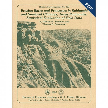
Erosion Rates and Processes in Subhumid and Semiarid Climates, Texas Panhandle:... Digital Download
RI0162D
For a print version: RI0162.
RI0162D. Erosion Rates and Processes in Subhumid and Semiarid Climates, Texas Panhandle: Statistical Evaluation of Field Data, by W. W. Simpkins and T. C. Gustavson. 54 p., 40 figs., 18 tables, 1 oversize plate, 1987. doi.org/10.23867/RI0167D. Downloadable PDF.
To purchase this publication in book format, please order RI0162.
ABSTRACT
Since 1978, six climate- and erosion-monitoring stations on slopes in draws and large playa lake basins in the interior of the Southern High Plains and slopes along the Caprock Escarpment in the Rolling Plains of the Texas Panhandle have recorded precipitation amount and intensity, air and soil temperature, soil electrical resistance (soil moisture), slope erosion and deposition, and slope and stream headcut retreat. Stations are located in areas of active erosion. Slope erosion and deposition are measured using erosion pins, and stream headcut retreat is monitored with iron reinforcing rods (rebars). Both are deployed in outcrops of siltstones and mudstones of the Permian Quartermaster Formation, mudstones of the Triassic Dockum Group, calichified sandstones of the Tertiary Ogallala Formation, alluvial and colluvial sediments, and thin, poorly developed soils on these parent materials.
The climate of the Texas Panhandle ranges from semiarid in the western High Plains to subhumid in the Rolling Plains east of the Caprock Escarpment. Short-duration, high-intensity precipitation from frontal or convective storms is prevalent from May through September; longer duration, low-intensity precipitation occurs during the rest of the year. Mean maximum rainfall intensity per storm from 1978 through 1983 is 11.7 mm/hr (0.46 inch/hr). Maximum 30-min rainfall intensity recorded is 75 mm/hr (3.00 inches/hr). Maximum rainfall recorded during a 24-hr period is 112.8 mm (4.44 inches).
Sediment displaced as high as 25 cm (10 inches) on erosion pins, sealed soil surfaces from the beating action of raindrops, and the presence of natural and artificial hoodoos demonstrate potential for rainsplash erosion in the study area. However, runoff (both sheetwash and rillwash) dominates slope erosion and sediment transport processes. Sheetwash is channeled between clump grasses. Rills form in most substrates in the study area but are preserved mostly in fine-grained sediment. Gullying, aided by slumping during bank undercutting, produces stream-headcut retreat.
The magnitude of precipitation intensity relative to soil infiltration rate controls the amount of runoff produced. Soil moisture and soil surface composition influence infiltration rates. Soils at the monitoring stations exhibit seasonal moisture variations, the periods of higher soil moisture (November through May) having the highest potential for generating runoff. Loam and silty loam soils at the stations retain soil water longer than do sandy soils and are more likely to produce runoff. Soil surfaces sealed by clay and vegetal crusts inhibit infiltration and increase runoff.
Analysis of 3,770 erosion-pin measurements taken at 6-mo intervals for 3-yr periods from1978 through 1983 indicates that net erosion predominates at most of the monitoring sites. Data on erosion and deposition at the six stations are unimodally distributed about a mean of -0.14 cm (-0.06 inch). Highest annual rates of erosion during the same period are at Palo Duro Canyon State Park (-0.61 cm/yr; -0.24 inch/yr) and Caprock Canyons State Park-West (-0.40 cm/yr; -0.16 inch/yr). Deposition, a manifestation of sediment storage, is occurring at both the Buffalo Lake station (+0.20 cm/yr; +0.08 inch/yr) and the Caprock Canyons State Park-East station (+0.21 cm/yr; +0.08 inch/yr). These rates compare closely with published rates for subhumid and semiarid climates. Slope retreat rates and stream headcut rates measured from rebars range from 0.8 to 1.7 cm/yr (0.31 to 0.67 inch/yr) in calichified Ogallala and Blackwater Draw sediments to 6.7 to 72.4 cm/yr (2.6 to 28.5 inches/yr) in alluvial sediment.
A four-stage model of escarpment retreat was constructed utilizing variations in slope and stream headcut retreat and erosion rates among stations, soils, and slope positions. Mass movement, overland flow, and fluvial processes act in concert to loosen and then transport material from slopes. Parallel retreat of the model escarpment occurs in discrete steps that proceed at slightly different rates. A complete cycle through the model may take tens to hundreds of years, resulting in tens of feet of slope retreat.
Regression analysis and analysis of variance were applied to four data sets to determine controls on erosion and deposition. Stepwise multiple regression analysis of all variables (data set 1) indicates that increases in amounts of erosion are significantly correlated (p = 0.10) with increasing slope angle, increasing percent sand and clay, and decreasing percent vegetal cover. Increases in amounts of deposition are significantly correlated with increases in amount of rainfall per event and decreases in slope angle and percent iron oxide. Precipitation intensity (rainfall per event) is a significant predictor (p = 0.05) of percent of erosion pins showing erosion and deposition (data set 2) between measurement intervals. A significant correlation exists between maximum 30-min precipitation intensity and percent of erosion pins displaying erosion at the Buffalo Lake station (data set 3). The percentage of erosion pins showing erosion is not significantly different (p = 0.05) between slope aspects. Significantly higher (p = 0.05) amounts of erosion occur in the spring and summer, coincident with higher rainfall (data set 4).
Weak correlations between erosion, deposition, and predictor variables are due to variations in the dependent variable. Operator measurement error, processes created by the presence of the erosion pin, and nonmeasured processes contribute to this variation. Geomorphic thresholds may contribute variation by introducing nonlinear or stepped responses into the data set. The extent of influence of the predictor variables may depend on whether geomorphic thresholds are reached. Critical geomorphic thresholds of precipitation intensity (extrinsic threshold) and sediment availability or storage (intrinsic threshold) influence the total amount of erosion. A geomorphic process model, based on data from the
Buffalo Lake station, demonstrates the interaction between intrinsic and extrinsic thresholds in producing erosion. Precipitation intensities reaching the extrinsic intensity threshold have recurrence intervals of approximately 10 yr at the Buffalo Lake station; simultaneous attainment of extrinsic and intrinsic thresholds producing maximum sediment yield occurred only once (May 26, 1978).
Keywords: erosion processes, erosion rates, semiarid climate, statistical analyses, subhumid climate, Texas Panhandle, Texas
Citation
Simpkins, W. W., and Gustavson, T. C., 1987, Erosion Rates and Processes in Subhumid and Semiarid Climates, Texas Panhandle: Statistical Evaluation of Field Data: The University of Texas at Austin, Bureau of Economic Geology, Report of Investigations No. 162, 54 p.
